Carrauntoohil
The highest mountain in Ireland at 1,038 metres, climbed by an eroded gully or a longer ridge circuit above corrie lakes.
Updated 4 September 2026
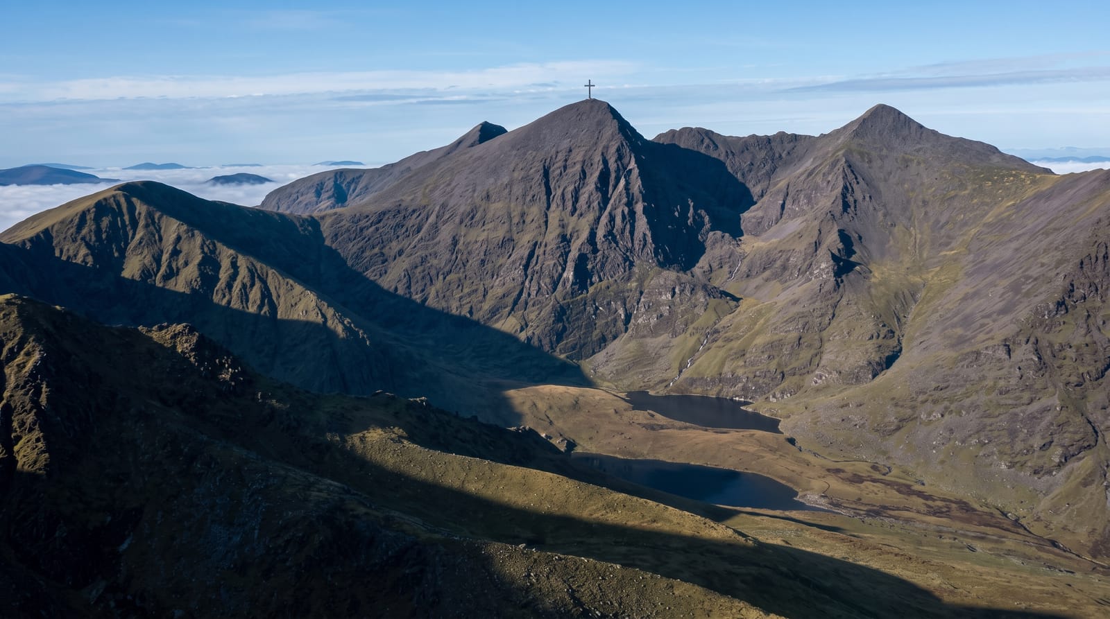
AI illustration
Carrauntoohil is the highest mountain in Ireland at 1,038 metres, the centre of MacGillycuddy's Reeks, a sandstone range of narrow ridges and glacial corries west of Killarney. The usual approach goes up the Devil's Ladder, a steep eroded gully of loose rock that is more scramble than path and has degraded badly under traffic. Experienced walkers prefer the Coomloughra Horseshoe, a longer circuit taking in the second and third highest tops in the country. A large steel cross stands on the summit. Return times run from five to seven hours, and the weather at the top rarely matches the weather down in the car park.
Highlights
- The summit cross - the steel cross standing on the highest point in Ireland.
- The Devil's Ladder - the eroded gully used by most ascents.
- The Coomloughra Horseshoe - the ridge circuit over the neighbouring high tops.
- The corrie lakes - dark tarns held in the glacial bowls below the ridge.
When to go
May to September gives the longest daylight and the best settled spells, though rain can arrive on any of those days. Start early and set a turnaround time before you go. Winter ascents need ice axe skills and are not a walk. Check the mountain forecast rather than the town one, and carry a map and compass you can use in cloud.
Practical notes
This is a serious mountain day, and rescue teams are called out here regularly to people in trainers navigating by phone. The Devil's Ladder is loose, with rockfall risk when parties stack up inside it. Cloud covers the summit on most days, so the view is not guaranteed. Descending the gully is harder and slower than going up it.
Nearby
Killarney is half an hour east; the Gap of Dunloe cuts the eastern edge of the range.
Key facts
Source: Wikidata, item Q503368, read on 18 October 2026.
What to pack for Carrauntoohil
Chosen from what this place is for. Tap a kit for the full checklist.
- Broken-in walking shoes or boots - Grip and ankle support matter more than looks; never hike in brand-new boots. Find on Amazon
- Layers for big temperature swings - Warm sun by day, near-freezing at night, even near the equator. Find on Amazon
- Layers + a waterproof shell - Mountain weather turns fast; a packable rain jacket saves the day. Find on Amazon
- Extra-strong sun protection - Thin air means fierce UV; hat, sunglasses and high-SPF sunscreen. Find on Amazon
Some links on this page are Amazon affiliate links - if you buy through them we may earn a small commission at no extra cost to you.
All packing kitsPlan your trip
Where to start if Carrauntoohil is going on the list.
Booking links on this page are affiliate links - if you book through them we may earn a small commission at no extra cost to you. It never changes what we write about a place.
Opening times, ticket prices and seasonal closures change - check the official source before you go: official site.