MacGillycuddy's Reeks
Ireland's highest range - a glaciated sandstone ridge in Kerry carrying every summit in the country above a thousand metres.
Updated 28 August 2026
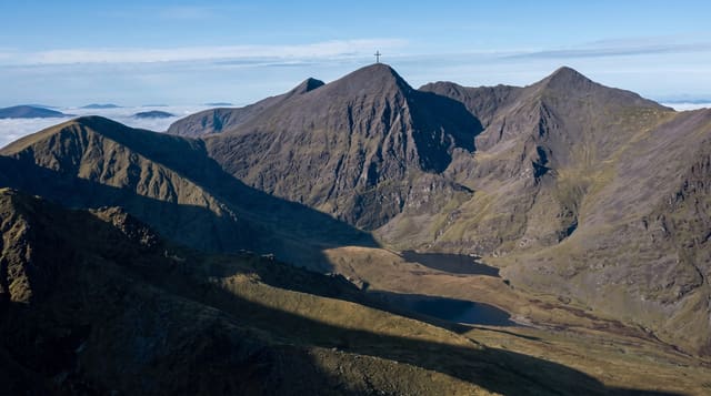
The Reeks run about twenty kilometres east to west in south Kerry and hold every peak in Ireland over a thousand metres, including Carrauntoohil at 1,038. The rock is Devonian sandstone, folded and then carved by ice into a ridge of steep corries, arêtes and hanging valleys - much more alpine in character than anything else in the country. The classic day is the Coomloughra Horseshoe, taking in Caher, Carrauntoohil and Beenkeragh on a narrow connecting ridge; the Hag's Glen approach to the Devil's Ladder is the commonest route to the summit and the most eroded. This is serious mountain ground. The weather changes without warning, cloud sits on the tops most days, there is no phone coverage in the corries, and this is one of the busiest mountain rescue areas in Ireland. Most of the land is privately farmed, and access depends on landowner goodwill.
What's there
- Carrauntoohil - 1,038 metres, the highest point in Ireland.
- The ridges - Beenkeragh and the arête, narrow and exposed.
- The corries - Coomloughra and the Hag's Glen, ice-carved.
- The sandstone - folded Devonian rock, more alpine than the rest of Ireland.
When to go
May to September for daylight and settled weather, though conditions change fast in any month. Winter here needs axe, crampons and the skill to use them.
Good to know
Genuinely dangerous ground - one of Ireland's busiest mountain rescue areas. The Devil's Ladder is loose and eroded, with rockfall onto people below. No phone coverage in the corries. Land is privately farmed; park where signed and close gates.
Nearby
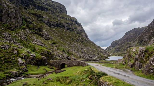
Killarney National Park is east; the Gap of Dunloe cuts the range's eastern end.
Key facts
Source: Wikidata, item Q1366878, read on 18 October 2026.
What to pack for MacGillycuddy's Reeks
Chosen from what this place is for. Tap a kit for the full checklist.
- Broken-in walking shoes or boots - Grip and ankle support matter more than looks; never hike in brand-new boots. Find on Amazon
- Layers + a waterproof shell - Mountain weather turns fast; a packable rain jacket saves the day. Find on Amazon
- Daypack with rain cover - 20-30 litres holds water, snacks, layers and a first-aid kit. Find on Amazon
- Offline maps + a power bank - Download the trail before you lose signal; carry backup charge. Find on Amazon
Some links on this page are Amazon affiliate links - if you buy through them we may earn a small commission at no extra cost to you.
All packing kitsPlan your trip
Where to start if MacGillycuddy's Reeks is going on the list.
Booking links on this page are affiliate links - if you book through them we may earn a small commission at no extra cost to you. It never changes what we write about a place.
Opening times, ticket prices and seasonal closures change - check the official source before you go: official site.