Tinakula
An active volcanic cone rising straight out of the sea in the eastern Solomons.
Updated 16 October 2026
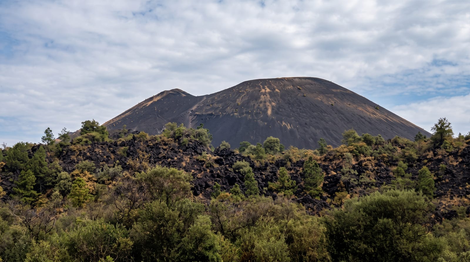
Tinakula stands north of Nendo in the eastern Solomons, a steep volcanic cone rising some eight hundred and fifty metres straight out of deep water with a scar of loose ash running down one flank into the sea. It erupts regularly, and the population that once lived on it was evacuated. Boats from Lata pass it and the cone is visible for a long way in clear weather.
Background
Tinakula is a conical stratovolcano in the northern part of the Santa Cruz Islands, about 3.5 kilometres wide, rising 851 metres above sea level and some 3 to 4 kilometres above the sea floor. It has also been called Tamami or Volcano Island. Its first recorded eruption was seen in 1595, when Álvaro de Mendaña sailed past on his second Pacific expedition. Around 1840 pyroclastic flows swept every side of the island and wiped out the people living there. Settlers from Nukapu and Nupani arrived in 1951 and reached a peak of 160 before the 1971 eruption forced them to leave. In March 1927 the Whitney South Sea Expedition landed to collect birds for the American Museum of Natural History.
Source: Wikipedia, "Tinakula"
Highlights
- The cone - some eight hundred and fifty metres rising straight from the sea.
- The ash chute - the scar running down one flank into the water.
- The activity - a volcano that erupts regularly and is watched.
- The empty island - a cone with no permanent population.
When to go
May to October is the drier season and calmest. Volcanic activity determines whether boats approach. Cyclone season runs November to April.
What to expect
Landing is generally not permitted and depends entirely on volcanic activity. Boats must be chartered from Lata and there is no scheduled service. Getting to Temotu at all requires a flight to Lata that is often cancelled.
Nearby
Nendo is south, and Lata is on it.
Key facts
Source: Wikidata, item Q986896, read on 18 October 2026.
What to pack for Tinakula
Chosen from what this place is for. Tap a kit for the full checklist.
- Broken-in walking shoes or boots - Grip and ankle support matter more than looks; never hike in brand-new boots. Find on Amazon
- Shelter suited to the place - Tent, tarp or hut booking - match it to the terrain and rules. Find on Amazon
- Layers + a waterproof shell - Mountain weather turns fast; a packable rain jacket saves the day. Find on Amazon
- A warm sleeping bag + mat - Rated a little colder than you expect the nights to be. Find on Amazon
Some links on this page are Amazon affiliate links - if you buy through them we may earn a small commission at no extra cost to you.
All packing kitsPlan your trip
Where to start if Tinakula is going on the list.
Booking links on this page are affiliate links - if you book through them we may earn a small commission at no extra cost to you. It never changes what we write about a place.
Opening times, ticket prices and seasonal closures change - check the official source before you go: official site.