Tikopia
A tiny Polynesian island in the far east, long studied for how it managed its own limits.
Updated 16 October 2026
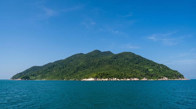
Tikopia is a small volcanic island in the far east of the Solomons with a crater lake taking up much of it and around a thousand Polynesian people living on the rest. It became widely known through Raymond Firth's fieldwork and later through accounts of how the island regulated its own population and food supply within very hard limits. It is among the most isolated inhabited places in the Pacific.
Background
Tikopia covers 5 square kilometres and is what remains of an extinct volcano, with Mount Reani rising to 380 metres. Lake Te Roto fills an old crater 80 metres deep and held fresh water until a storm in 2002 broke its narrow barrier to the sea. About 1,200 people live there, in more than 20 villages, most of them coastal. Europeans first arrived on 22 April 1606, with a Spanish expedition under Pedro Fernandes de Queirós. Around 1600 the islanders agreed to kill every pig and turn to fishing, to save food for people. Tikopia also helped solve the mystery of the Lapérouse expedition, missing since 1788, and in May 1826 an island navigator guided Peter Dillon's ship to Vanikoro.
Source: Wikipedia, "Tikopia"
What you'll find
- The crater lake - the brackish water filling much of the island.
- The Polynesian community - around a thousand people on a very small island.
- The garden system - the intensive cultivation the island lives on.
- The isolation - days of open ocean from anywhere with an airstrip.
When to go
May to October is the drier season. Ships run irregularly, sometimes months apart. Cyclones affect the island from November.
What to expect
There is no airstrip and the only access is an irregular ship; visits mean weeks or months, not days. Chiefly permission is required to land and stay. There are no facilities of any kind.
Nearby
Anuta is northeast, and Lata is far northwest.
Key facts
Source: Wikidata, item Q889519, read on 18 October 2026.
What to pack for Tikopia
Chosen from what this place is for. Tap a kit for the full checklist.
- Travel rod + reel - A packable multi-piece rod fits in a case and covers most holiday fishing. Find on Amazon
- Reef-safe sunscreen - High SPF that will not bleach the coral you are swimming over. Find on Amazon
- Shelter suited to the place - Tent, tarp or hut booking - match it to the terrain and rules. Find on Amazon
- A small tackle selection - Hooks, weights, line and a few lures or flies suited to local waters. Find on Amazon
Some links on this page are Amazon affiliate links - if you buy through them we may earn a small commission at no extra cost to you.
All packing kitsPlan your trip
Where to start if Tikopia is going on the list.
Booking links on this page are affiliate links - if you book through them we may earn a small commission at no extra cost to you. It never changes what we write about a place.
Opening times, ticket prices and seasonal closures change - check the official source before you go: official site.