Paricutin
The volcano that grew in a cornfield - born in 1943, it buried two villages and left a church tower standing alone in a black lava sea.
Updated 4 September 2026
AI illustration
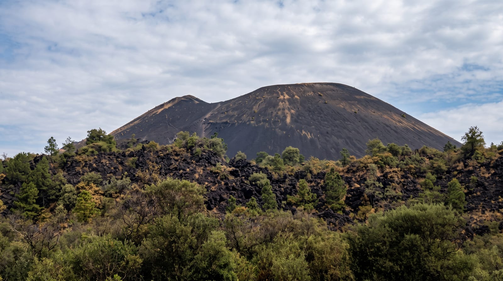
On 20 February 1943 a farmer named Dionisio Pulido watched a fissure open in his cornfield and begin to throw ash. Within a day it was a cone taller than a house; within a year, several hundred metres; and over nine years of eruption Paricutin buried the villages of Paricutin and San Juan Parangaricutiro under lava, giving science its first chance to watch a volcano's entire life from birth to extinction. The result is Michoacan's strangest landscape: a black lava sea, hardened into jagged pressure ridges and studded with pines that have recolonized the margins, out of which rises the tower and altar wall of San Juan's church - the lava stopped at the sanctuary and left it standing, and pilgrims still leave candles and flowers at the exposed altar. Purepecha guides from Angahuan run the two classic trips: the short ride or walk to the buried church, and the long day to the crater rim - hours across the malpais and then a lung-burning ascent of loose black scoria, rewarded by a warm, steaming summit and the whole cornfield-turned-badlands below.
Highlights
- The buried church - San Juan's tower and altar in the lava.
- The malpais - kilometres of black jagged flow.
- The cone - the 1943 volcano from base to steaming rim.
- The Angahuan mirador - the whole story in one panorama.
When to go
November to May for dry, firm going; start the summit trip early, as the crossing plus climb runs six to eight hours round trip. Horses cover the flat approach for most parties.
Good to know
The summit day is hard: sun-exposed lava fields, loose scoria at 45 degrees, and altitude near 2,800 metres. Hire local guides in Angahuan - it is the community's livelihood and the route is genuinely easy to misjudge. Bring water, sun cover and closed shoes.
Nearby
Angahuan's wooden Purepecha church, Uruapan's park and the avocado country between fill the return.
Key facts
Source: Wikidata, item Q231620, read on 18 October 2026.
What to pack for Paricutin
Chosen from what this place is for. Tap a kit for the full checklist.
- Broken-in walking shoes or boots - Grip and ankle support matter more than looks; never hike in brand-new boots. Find on Amazon
- Modest clothing - Shoulders and knees covered - the single most common requirement. Find on Amazon
- Layers + a waterproof shell - Mountain weather turns fast; a packable rain jacket saves the day. Find on Amazon
- A scarf or shawl - To cover the head or shoulders on entry; women especially at mosques. Find on Amazon
Some links on this page are Amazon affiliate links - if you buy through them we may earn a small commission at no extra cost to you.
All packing kitsPlan your trip
Where to start if Paricutin is going on the list.
Booking links on this page are affiliate links - if you book through them we may earn a small commission at no extra cost to you. It never changes what we write about a place.
Opening times, ticket prices and seasonal closures change - check the official source before you go: official site.