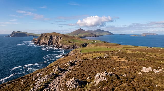
Conor Pass
Ireland's highest surfaced mountain pass, a single-track road cut into a cliff across the Dingle peninsula.
Updated 28 August 2026
The Conor Pass crosses the spine of the Dingle peninsula at about 456 metres, which makes it the highest surfaced mountain pass in Ireland. For much of the northern descent the road is a single lane cut into a rock face, with the cliff on one side, an unguarded drop on the other, and water running down the rock and across the tarmac. There are passing places but not enough of them, and meeting a vehicle coming the other way means one of you reverses. Buses, coaches and vehicles over two tonnes are prohibited, and the restriction is not advisory - camper vans regularly get stuck. At the top there is a small car park and a view north over Brandon Bay and south to Dingle harbour, and a short walk up beside a stream leads to a hanging corrie lake, Loch an Duin, with waterfalls coming off the headwall.
What's there
- The cut road - single-lane, carved into the cliff on the northern side.
- The summit view - Brandon Bay north, Dingle harbour south.
- Loch an Duin - the corrie lake on the short walk up from the car park.
- The height - 456 metres, the highest surfaced pass in Ireland.
When to go
May to September. The pass closes in snow and ice, and driving it in fog or heavy rain is genuinely unpleasant. Early morning avoids the worst of the two-way traffic.
Practical notes
Single-lane with an unguarded drop and inadequate passing places. Over two tonnes is prohibited, campers included, and ignoring that blocks the road for everyone. Cloud frequently removes the view entirely.
Nearby
Dingle town is south; Brandon Bay and Mount Brandon are north.
Key facts
Source: Wikidata, item Q267446, read on 18 October 2026.
What to pack for Conor Pass
Chosen from what this place is for. Tap a kit for the full checklist.
- Broken-in walking shoes or boots - Grip and ankle support matter more than looks; never hike in brand-new boots. Find on Amazon
- Warm base layers - Merino or synthetic against the skin - never cotton, which chills when damp. Find on Amazon
- Layers + a waterproof shell - Mountain weather turns fast; a packable rain jacket saves the day. Find on Amazon
- An insulated + windproof jacket - A down or synthetic layer under a hard shell handles most cold. Find on Amazon
Some links on this page are Amazon affiliate links - if you buy through them we may earn a small commission at no extra cost to you.
All packing kitsPlan your trip
Where to start if Conor Pass is going on the list.
Booking links on this page are affiliate links - if you book through them we may earn a small commission at no extra cost to you. It never changes what we write about a place.
Opening times, ticket prices and seasonal closures change - check the official source before you go: official site.