Col du Tourmalet
The most climbed pass in Tour de France history, at 2,115 metres, with a giant cyclist statue at the top.
Updated 4 September 2026
AI illustration
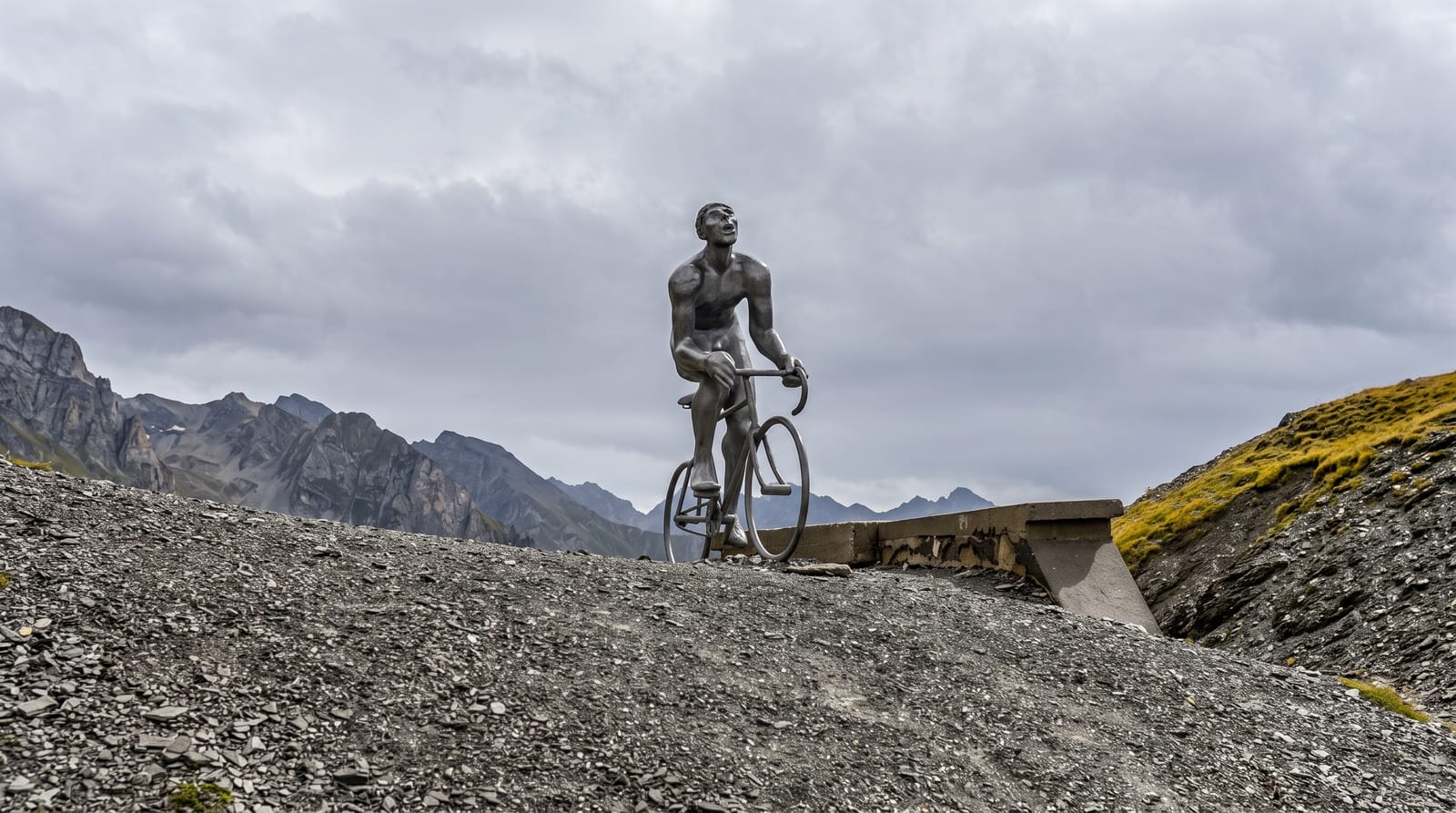
At two thousand one hundred and fifteen metres the Tourmalet is the highest paved pass in the central Pyrenees and has appeared in the Tour de France more often than any other climb, first crossed in 1910 when the organisers were unsure the road was rideable at all. A sculpture called Le Geant du Tourmalet, a stylised cyclist, stands at the summit through the summer and is taken down and carried to Bagneres-de-Bigorre for the winter in a small local ceremony. The climb is about nineteen kilometres from Luz-Saint-Sauveur. The Pic du Midi observatory can be reached by cable car from La Mongie on the eastern side.
What to look for
- The summit marker - the pass sign at 2,115 metres with the giant cyclist.
- The Tour history - plaques and memorials to the climb's riders.
- The Pic du Midi - the observatory reached by cable car from La Mongie.
- The two ascents - long climbs from Luz and from Sainte-Marie-de-Campan.
When to go
June to October; the pass is closed by snow for much of the year, usually reopening late spring. Tour de France stage days close the road entirely to vehicles.
Before you go
Opening dates vary by year and are published late. Weather at the summit can be cold and clouded in August. Cyclists and traffic share a narrow road in summer.
Nearby
Lourdes lies northwest; the Cirque de Gavarnie is southwest.
Key facts
Source: Wikidata, item Q942322, read on 18 October 2026.
What to pack for Col du Tourmalet
Chosen from what this place is for. Tap a kit for the full checklist.
- Padded shorts - The one thing that makes a full day in the saddle bearable. Find on Amazon
- Spare batteries + cards - Cold and long shoots drain power; never run out at the good light. Find on Amazon
- Warm base layers - Merino or synthetic against the skin - never cotton, which chills when damp. Find on Amazon
- Comfortable walking shoes - Sightseeing means kilometres of pavement and cobbles daily. Find on Amazon
Some links on this page are Amazon affiliate links - if you buy through them we may earn a small commission at no extra cost to you.
All packing kitsPlan your trip
Where to start if Col du Tourmalet is going on the list.
Booking links on this page are affiliate links - if you book through them we may earn a small commission at no extra cost to you. It never changes what we write about a place.
Opening times, ticket prices and seasonal closures change - check the official source before you go: official site.