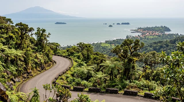
Mount St. Catherine
Grenada's highest point, a dormant volcano climbed through elfin forest.
Updated 3 September 2026
Mount St. Catherine rises to 840 metres in northern Grenada and is the highest point on the island, a dormant volcano whose slopes carry rainforest at the bottom and stunted elfin woodland near the top where the cloud sits almost permanently. There is no maintained trail and the route is steep, overgrown and muddy throughout. A guide is required. The summit view, when it clears, runs the length of the island.
What's there
- The summit - 840 metres and the highest point in Grenada.
- The elfin forest - stunted cloud-soaked woodland near the top.
- The volcanic form - a dormant cone with its slopes cut by ravines.
- The island view - the length of Grenada from the top when cloud allows.
When to go
January to May is the dry season and the only sensible window. Cloud covers the summit most days year round. Wet season conditions make the route dangerous.
Practical notes
There is no maintained trail and the route is overgrown, steep and muddy; a guide is mandatory. The summit is in cloud most of the time and the view is not guaranteed. It is a hard full day.
Nearby
Victoria is west, and Grenville is east.
What to pack for Mount St. Catherine
Chosen from what this place is for. Tap a kit for the full checklist.
- Broken-in walking shoes or boots - Grip and ankle support matter more than looks; never hike in brand-new boots. Find on Amazon
- Strong insect repellent - DEET or picaridin; the jungle is where bites and disease risk are highest. Find on Amazon
- Layers for big temperature swings - Warm sun by day, near-freezing at night, even near the equator. Find on Amazon
- Layers + a waterproof shell - Mountain weather turns fast; a packable rain jacket saves the day. Find on Amazon
Some links on this page are Amazon affiliate links - if you buy through them we may earn a small commission at no extra cost to you.
All packing kitsPlan your trip
Where to start if Mount St. Catherine is going on the list.
Booking links on this page are affiliate links - if you book through them we may earn a small commission at no extra cost to you. It never changes what we write about a place.
Opening times, ticket prices and seasonal closures change - check the official source before you go: official site.