Pico Basile
Bioko's cloud summit - a 3,011-metre volcano road through mist forest to the island's rooftop, with Cameroon's giant on the horizon.
Updated 19 October 2026

AI illustration
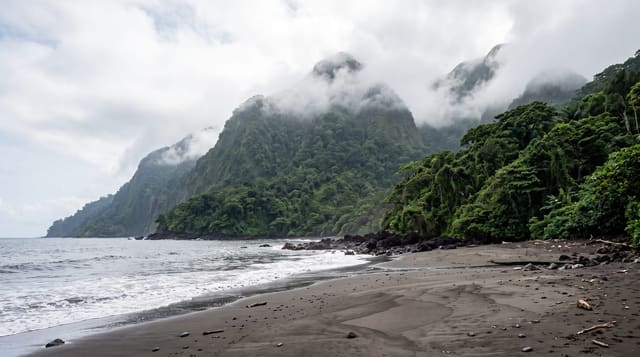
Bioko is a volcano wearing an island, and Pico Basile is its crown: 3,011 metres rising straight from the Gulf of Guinea, wrapped in cloud forest that drips with tree ferns, orchids and the calls of endemic birds - the road to the summit zone climbs through the whole sequence from cocoa belt to moss line, one of Africa's quickest sea-to-sky transects. On the clearest harmattan mornings the reward doubles: Mount Cameroon's massif floats across the strait, two volcanic giants regarding each other over the water. Access runs on permits arranged in Malabo - the summit area carries installations - and the mountain's weather keeps its own counsel.
History
Pico Basilé, formerly Pico de Santa Isabel or Clarence Peak, crowns the largest and highest of the three basalt shield volcanoes that make up Bioko, and it is the only one to have erupted in historic times, most recently in 1923. Its first ascent by Europeans was made by English officers of the Owen expedition between 1827 and 1828, and the first official ascent in 1839 by John Beecroft, later governor of the island. The peak became part of the Pico Basilé National Park, created in April 2000, and its summit now carries a broadcast station and relay masts (Wikipedia, Pico Basilé).
What you'll find
- The summit panorama - the island below and Cameroon across the strait.
- The cloud-forest road - tree ferns and orchids by the kilometre.
- The endemic birdlife - Bioko's specialities in the mist belt.
- The sea-to-sky transect - cocoa to moss line in an hour's climb.
When to go
November to February, the drier harmattan window, gives the best summit odds - mornings before the cloud builds are the appointment; the wet season drowns the road in mist.
Good to know
Permits and current access rules are the real trailhead - arrange through Malabo contacts or hotels before planning the day, and accept that summit-zone access can be limited. The road asks a sound vehicle; the temperature drop asks layers. Cloud refunds nothing but atmosphere.
Nearby
Malabo's colonial quarter and the island's cocoa villages.
Key facts
Source: Wikidata, item Q1518286, read on 18 October 2026.
What to pack for Pico Basile
Chosen from what this place is for. Tap a kit for the full checklist.
- Broken-in walking shoes or boots - Grip and ankle support matter more than looks; never hike in brand-new boots. Find on Amazon
- Binoculars - The single best wildlife tool - even a compact pair transforms a sighting. Find on Amazon
- Layers for big temperature swings - Warm sun by day, near-freezing at night, even near the equator. Find on Amazon
- Shelter suited to the place - Tent, tarp or hut booking - match it to the terrain and rules. Find on Amazon
Some links on this page are Amazon affiliate links - if you buy through them we may earn a small commission at no extra cost to you.
All packing kitsPlan your trip
Where to start if Pico Basile is going on the list.
Booking links on this page are affiliate links - if you book through them we may earn a small commission at no extra cost to you. It never changes what we write about a place.
Opening times, ticket prices and seasonal closures change - check the official source before you go: official site.