Drangarnir
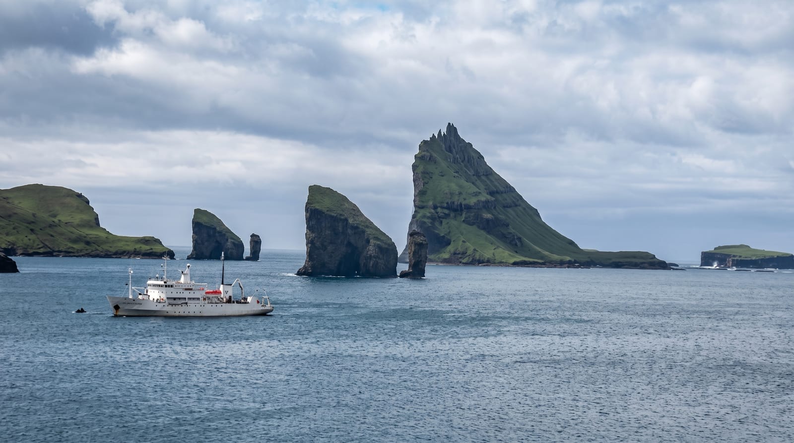
Two sea stacks off Vágar, one pierced by a natural arch, framing the pyramid island of Tindhólmur behind.
Updated 2 September 2026
AI illustration
Off the western tip of Vágar stand two sea stacks, Stóri Drangur and Lítli Drangur, known together as Drangarnir, and the larger one is pierced by a natural arch that the sea has driven clean through the rock. Behind them rises Tindhólmur, a small uninhabited island with five jagged peaks along its spine, and when the stacks, the arch and the island line up, the composition is one of the most photographed in the North Atlantic. Reaching it takes commitment: either a boat trip out from Sørvágur that noses towards the arch, or a demanding coastal hike of several hours that crosses private farmland and, by local rule, must be done with a licensed guide. The reward is a view that feels like the edge of the map.
What you'll find
- The sea arch - the hole driven through Stóri Drangur by the Atlantic.
- Tindhólmur - the five-peaked uninhabited island framed behind the stacks.
- The coastal hike - the guided walk out along the Vágar shore.
- Gásadalur - the cliff-edge waterfall village on the same peninsula.
When to go
May to September for the boat trips and the hike; both stop or become dangerous in the winter and in rough weather. Boats are cancelled in swell, and the hike needs a dry, clear day.
What to expect
There is no easy way to see it: the hike is long, steep, exposed and requires a paid licensed guide because it crosses private land, and the boat trips are weather-dependent and often cancelled. Neither is cheap. The famous head-on view with the arch and Tindhólmur aligned really only comes together from the water or from specific points on the hike, not from any roadside.
Nearby
Gásadalur and Múlafossur are on the same peninsula; Sørvágsvatn's clifftop lake is nearby.
Key facts
Source: Wikidata, item Q2314592, read on 18 October 2026.
What to pack for Drangarnir
Chosen from what this place is for. Tap a kit for the full checklist.
- Broken-in walking shoes or boots - Grip and ankle support matter more than looks; never hike in brand-new boots. Find on Amazon
- Spare batteries + cards - Cold and long shoots drain power; never run out at the good light. Find on Amazon
- Layers + a waterproof shell - Mountain weather turns fast; a packable rain jacket saves the day. Find on Amazon
- A compact tripod - Essential for night skies, aurora, waterfalls and low light. Find on Amazon
Some links on this page are Amazon affiliate links - if you buy through them we may earn a small commission at no extra cost to you.
All packing kitsPlan your trip
Where to start if Drangarnir is going on the list.
Booking links on this page are affiliate links - if you book through them we may earn a small commission at no extra cost to you. It never changes what we write about a place.
Opening times, ticket prices and seasonal closures change - check the official source before you go: official site.