Yorkshire Dales National Park
Limestone country of drystone walls, hay meadows and green valleys, with pavements, potholes and the three-peaks skyline above Ribblesdale.
Updated 18 October 2026
AI illustration
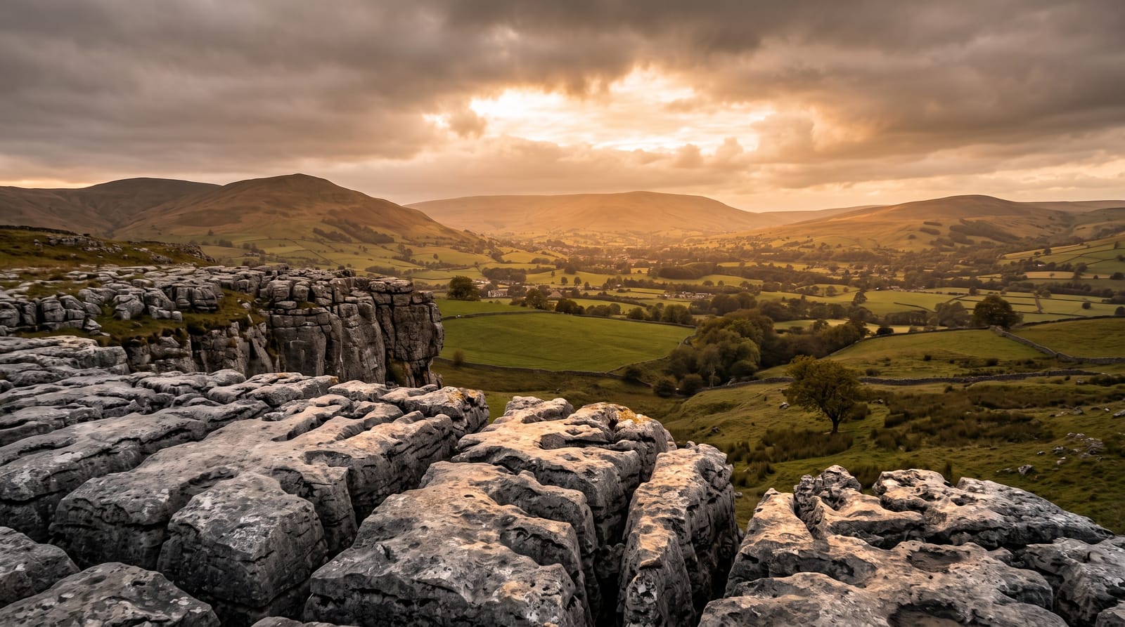
The Dales are made of carboniferous limestone, and once you see that you see everything else. Rain dissolves the rock, so water disappears into potholes and comes back out as springs, leaving valleys that are green on the floor and grey along the tops. Malham Cove is the showpiece: a curved cliff about 80 metres high with a bare limestone pavement on its rim, blocks split by deep grooves. Ingleborough, Whernside and Pen-y-ghent form the Three Peaks circuit, a long day that most people underestimate. Elsewhere it is quieter than that suggests - field barns and drystone walls above Swaledale, hay meadows in flower at Muker in June, waterfalls at Aysgarth and Hardraw, and villages of dark stone where the pace has not changed much.
History
The Yorkshire Dales were designated a national park in 1954. In 2016 the boundary was pushed west into Lancashire and Westmorland, adding nearly a quarter to its area, which now stands at about 2,178 square kilometres. Whernside, at 736 metres, is the highest of the Three Peaks. Some 23,500 people lived inside the park in 2017, and a 2018 report put visitors at more than four million a year (Wikipedia, Yorkshire Dales National Park).
The landscape
- Malham Cove - the curved limestone cliff and the pavement on top.
- Swaledale field barns - hundreds of stone barns in walled meadows.
- Aysgarth Falls - three sets of stepped falls on the River Ure.
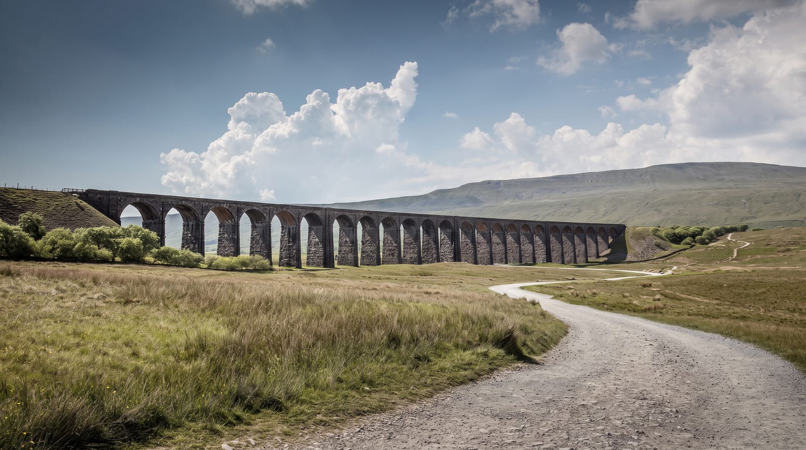
- Ribblehead Viaduct - 24 arches carrying the Settle-Carlisle line across open moor.
When to go
Late May and June are best: hay meadows are in flower, days are long and the fells are dry underfoot. Autumn is quieter with better light. Winter closes some upland roads and brings low cloud. Book accommodation early for summer weekends and for Three Peaks weekends in particular.
Practical notes
Malham on a fine Saturday has full car parks by mid-morning and a queue up the steps. Limestone pavement is genuinely dangerous in the wet, with deep grooves that swallow a leg. The Three Peaks walk is about 38 kilometres with a lot of ascent, and rescue callouts are common. Village parking is limited and expensive.
Nearby
The Lake District lies west, and the market towns of Skipton and Settle sit at the southern edge.
Key facts
Source: Wikidata, item Q20602688, read on 18 October 2026.
What to pack for Yorkshire Dales National Park
Chosen from what this place is for. Tap a kit for the full checklist.
- Broken-in walking shoes or boots - Grip and ankle support matter more than looks; never hike in brand-new boots. Find on Amazon
- Binoculars - The single best wildlife tool - even a compact pair transforms a sighting. Find on Amazon
- Layers + a waterproof shell - Mountain weather turns fast; a packable rain jacket saves the day. Find on Amazon
- A zoom camera or long lens - Animals rarely come close; reach beats megapixels. Find on Amazon
Some links on this page are Amazon affiliate links - if you buy through them we may earn a small commission at no extra cost to you.
All packing kitsPlan your trip
Where to start if Yorkshire Dales National Park is going on the list.
Booking links on this page are affiliate links - if you book through them we may earn a small commission at no extra cost to you. It never changes what we write about a place.
Opening times, ticket prices and seasonal closures change - check the official source before you go: official site.