The Rwenzori Mountains
Equatorial glaciers above bogs of giant heather and groundsel, on a range the ancients called the Mountains of the Moon.
Updated 8 August 2026
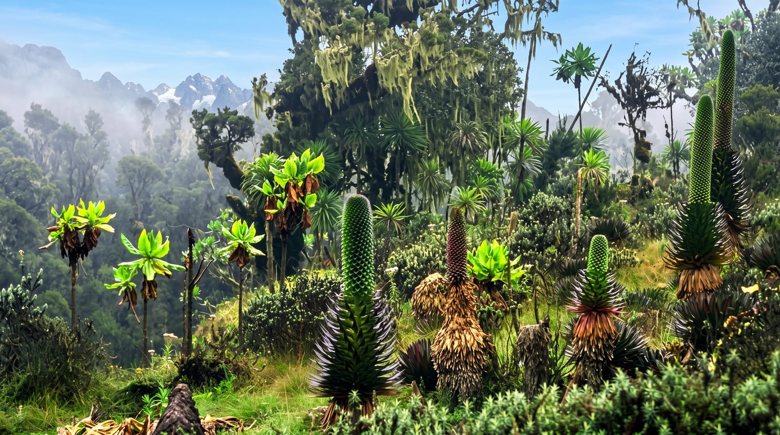
AI illustration
UNESCO World Heritage
The Rwenzori is not a volcanic range but a block of ancient rock pushed up along the rift, and it carries the third-highest peak in Africa, Margherita at 5,109 metres, along with some of the continent's last glaciers, which are retreating fast and measurably. What makes the trek unlike anything else is the vegetation on the way up: zones of bamboo, then giant heather hung with moss, then an Afroalpine world of groundsel and lobelia several metres tall standing over black bog. The ground is the defining feature. Much of the lower route crosses waterlogged moss and mud where every step sinks, which is why the Rwenzori has a reputation as the wettest and hardest of Africa's big treks.
Highlights
- Afroalpine zone - giant groundsel and lobelia above the heather belt.
- The glaciers - shrinking ice on Margherita and neighbouring peaks.
- Bigo bog - the notorious boardwalked and unboardwalked wetland crossing.
- The circuit huts - the chain of mountain huts on the central route.
When to go
June to August and December to February are the drier windows, which here means less rain rather than dry. Snow and ice conditions on the summit vary; the technical section needs a climbing guide and equipment.
Before you go
This is the wettest major trek in Africa and the mud is genuinely relentless; gaiters and proper boots are not optional and everything gets soaked. Guides and porters are compulsory and the cost is high. The summit push is a glacier climb requiring rope and crampons, not a walk. Many trekkers do the shorter routes to the Afroalpine zone and skip the peak entirely, which is a sensible choice.
Nearby
Queen Elizabeth National Park lies south; Fort Portal and the crater lakes are north.
Key facts
Source: Wikidata, item Q106540, read on 18 October 2026.
What to pack for The Rwenzori Mountains
Chosen from what this place is for. Tap a kit for the full checklist.
- Broken-in walking shoes or boots - Grip and ankle support matter more than looks; never hike in brand-new boots. Find on Amazon
- Warm base layers - Merino or synthetic against the skin - never cotton, which chills when damp. Find on Amazon
- Layers for big temperature swings - Warm sun by day, near-freezing at night, even near the equator. Find on Amazon
- Shelter suited to the place - Tent, tarp or hut booking - match it to the terrain and rules. Find on Amazon
Some links on this page are Amazon affiliate links - if you buy through them we may earn a small commission at no extra cost to you.
All packing kitsPlan your trip
Where to start if The Rwenzori Mountains is going on the list.
Booking links on this page are affiliate links - if you book through them we may earn a small commission at no extra cost to you. It never changes what we write about a place.
Opening times, ticket prices and seasonal closures change - check the official source before you go: official site.