Segla
A 639-metre sail-shaped peak rising sheer above a Senja fishing village, the island's signature climb.
Updated 4 September 2026

AI illustration
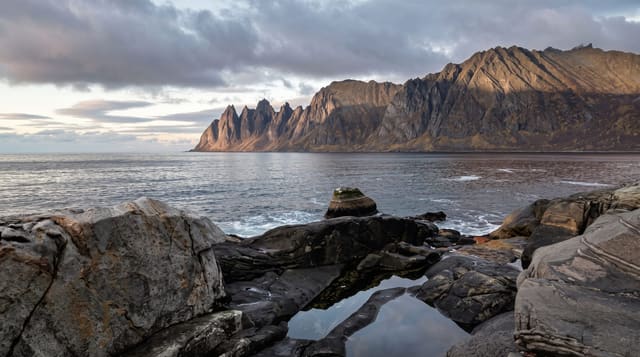
Segla, the sail, rises above the village of Fjordgard on Senja's outer coast as a blade of rock with a vertical northern face dropping some four hundred metres to the fjord and a walkable slope on the southern side. The path from Fjordgard climbs about two hours to the summit ridge, steep and rough near the top, and the reward is a narrow crest with the Bergsfjord on one side and the open sea on the other, with the neighbouring peak Hesten opposite. Hesten is in fact where most of the famous photographs of Segla are taken from, a separate walk of similar length. Senja is the second-largest island in Norway and its outer coast is a chain of similar peaks.
What you'll find
- The sail profile - a blade of rock with a sheer northern face.
- The summit crest - a narrow ridge with fjord and open sea below.
- Fjordgard - the fishing village directly beneath the peak.
- Hesten opposite - the neighbouring summit that gives the classic view of Segla.
When to go
June to September for the walk, when the path is clear; the midnight sun in June and July allows evening ascents. Winter attempts need full equipment and avalanche awareness, and the ridge is dangerous in wind.
Before you go
The path is steep, muddy and loose in sections, and the summit ridge has serious unprotected drops. Parking at Fjordgard is limited and charged, and overflow parking has caused friction with residents. Cloud on the peak is common.
Nearby
Hesten and Ersfjordstranda are along the same coast; the Senja scenic route runs around the island.
Key facts
Source: Wikidata, item Q31503316, read on 18 October 2026.
What to pack for Segla
Chosen from what this place is for. Tap a kit for the full checklist.
- Broken-in walking shoes or boots - Grip and ankle support matter more than looks; never hike in brand-new boots. Find on Amazon
- Travel rod + reel - A packable multi-piece rod fits in a case and covers most holiday fishing. Find on Amazon
- Spare batteries + cards - Cold and long shoots drain power; never run out at the good light. Find on Amazon
- Warm base layers - Merino or synthetic against the skin - never cotton, which chills when damp. Find on Amazon
Some links on this page are Amazon affiliate links - if you buy through them we may earn a small commission at no extra cost to you.
All packing kitsPlan your trip
Where to start if Segla is going on the list.
Booking links on this page are affiliate links - if you book through them we may earn a small commission at no extra cost to you. It never changes what we write about a place.
Opening times, ticket prices and seasonal closures change - check the official source before you go: official site.