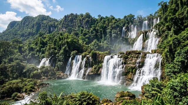
Mae Wong National Park
Cloud forest and a mist-covered camping ridge in the Western Forest Complex, and the site of a dam fight that conservationists won.
Updated 28 August 2026
Mae Wong covers about 890 square kilometres on the eastern edge of the Western Forest Complex, the largest block of protected forest in mainland Southeast Asia, and it connects to Huai Kha Khaeng and Thung Yai Naresuan. Chong Yen, a ridge at around 1,300 metres, is the main visitor point: a campsite and simple accommodation where cloud sits in the valleys on cool-season mornings, with hornbills, barbets and a long list of forest birds around it that make it a well-known birding destination. The park became nationally significant in 2013 when a proposed dam on the Mae Wong river, which would have flooded a stretch of lowland forest used by tigers dispersing from Huai Kha Khaeng, was contested by a campaign including a long protest march to Bangkok; the project was shelved. Roads within the park are rough, the climb to Chong Yen is slow, and facilities are basic.
What's there
- Chong Yen - the ridge campsite at around 1,300 metres, with morning cloud.
- The birdlife - hornbills, barbets and a long forest list.
- The forest complex - the eastern edge of the largest protected block in the region.
- The dam that was stopped - the 2013 campaign that shelved the reservoir.
When to go
November to February for weather and birding; the ridge is coldest and mistiest then. Book accommodation ahead for cool-season weekends. Roads are difficult in the rains.
Good to know
Rough internal roads and a slow climb to the ridge. Basic facilities. Tigers and large mammals are present but essentially never seen by visitors. Foreign entry fees are higher than Thai.
Nearby
Khlong Lan waterfall is east; Huai Kha Khaeng is south in Uthai Thani.
Key facts
Source: Wikidata, item Q739851, read on 18 October 2026.
What to pack for Mae Wong National Park
Chosen from what this place is for. Tap a kit for the full checklist.
- Broken-in walking shoes or boots - Grip and ankle support matter more than looks; never hike in brand-new boots. Find on Amazon
- Binoculars - The single best wildlife tool - even a compact pair transforms a sighting. Find on Amazon
- Shelter suited to the place - Tent, tarp or hut booking - match it to the terrain and rules. Find on Amazon
- Layers + a waterproof shell - Mountain weather turns fast; a packable rain jacket saves the day. Find on Amazon
Some links on this page are Amazon affiliate links - if you buy through them we may earn a small commission at no extra cost to you.
All packing kitsPlan your trip
Where to start if Mae Wong National Park is going on the list.
Booking links on this page are affiliate links - if you book through them we may earn a small commission at no extra cost to you. It never changes what we write about a place.
Opening times, ticket prices and seasonal closures change - check the official source before you go: official site.