Mount Ulawun
The highest volcano in the Bismarck Archipelago, a symmetrical cone on New Britain's north coast and one of the most active.
Updated 1 September 2026
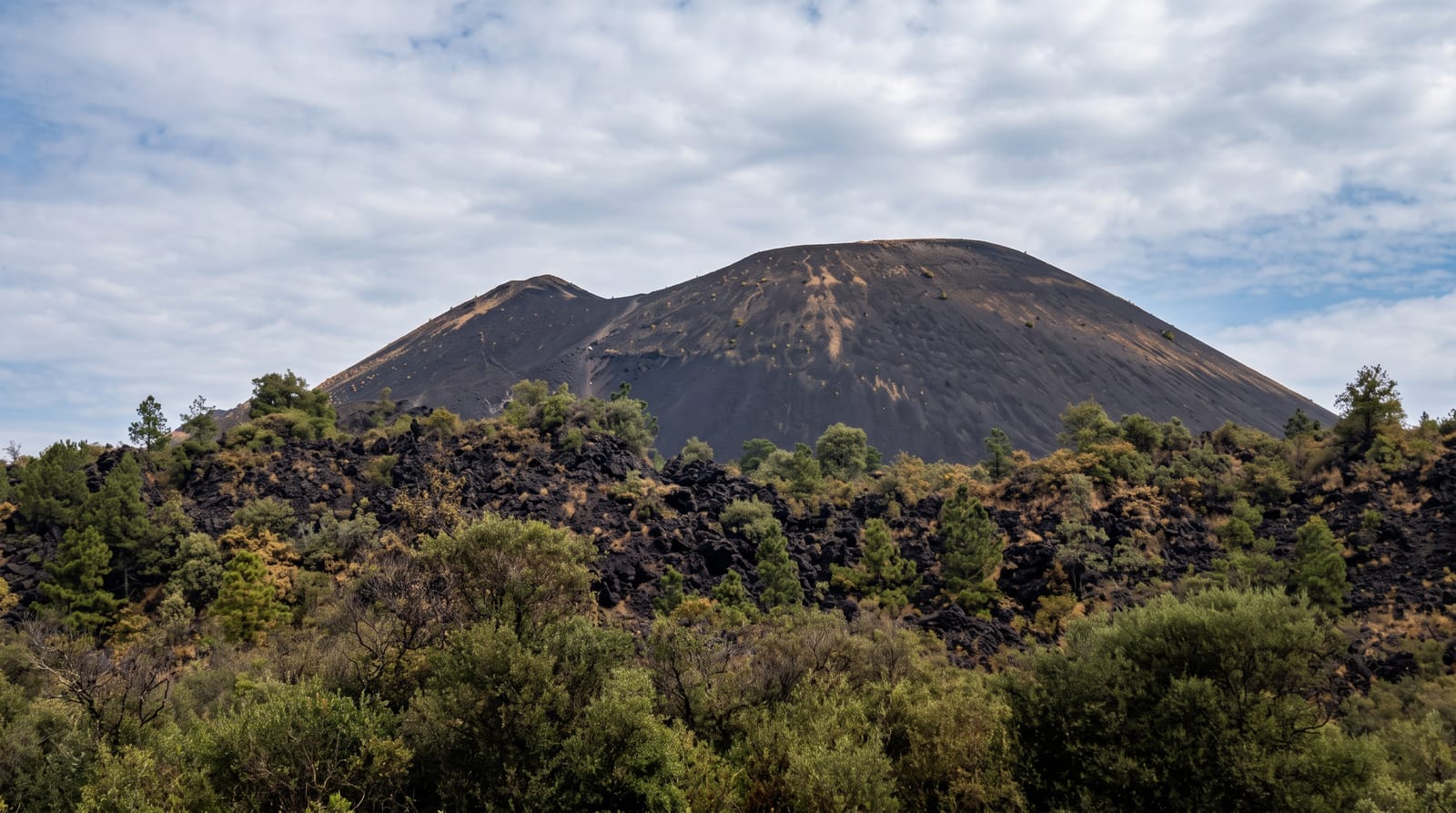
Ulawun rises to 2,334 metres directly from the north coast of New Britain, a near-perfect cone that is the highest point of the Bismarck Archipelago and among the most frequently active volcanoes in Papua New Guinea, with eruptions recorded through the twentieth and twenty-first centuries including a large one in 2019 that sent ash to great height and displaced villages nearby. It is designated a Decade Volcano for study because of the combination of activity and settlement around it. When quiet it can be climbed from the villages on the flanks with guides, a long steep day through gardens and then bare ash and rock, but activity closes it regularly.
What you'll find
- The cone - the symmetrical volcano rising straight from the coast.
- Ash and rock slopes - the bare upper mountain above the gardens.
- Village gardens - the cultivated lower flanks.
- The coast road view - the volcano seen from the road along the shore.
When to go
May to October in the drier season, and only when the volcano is quiet; activity closes access without notice and current status should be checked before planning. Climbs need guides and village permission.
Things to know
The volcano is frequently active and access is closed for long periods. Climbs are long, steep and hot with no water on the upper mountain. Village permission and guides are required. Ashfall affects the area during eruptions.
Nearby
Kimbe Bay lies west; the north coast road runs past the mountain.
Key facts
Source: Wikidata, item Q74158, read on 18 October 2026.
What to pack for Mount Ulawun
Chosen from what this place is for. Tap a kit for the full checklist.
- Broken-in walking shoes or boots - Grip and ankle support matter more than looks; never hike in brand-new boots. Find on Amazon
- Layers + a waterproof shell - Mountain weather turns fast; a packable rain jacket saves the day. Find on Amazon
- Daypack with rain cover - 20-30 litres holds water, snacks, layers and a first-aid kit. Find on Amazon
- Offline maps + a power bank - Download the trail before you lose signal; carry backup charge. Find on Amazon
Some links on this page are Amazon affiliate links - if you buy through them we may earn a small commission at no extra cost to you.
All packing kitsPlan your trip
Where to start if Mount Ulawun is going on the list.
Booking links on this page are affiliate links - if you book through them we may earn a small commission at no extra cost to you. It never changes what we write about a place.
Opening times, ticket prices and seasonal closures change - check the official source before you go: official site.