Pico de Orizaba
Mexico's highest mountain and the third highest in North America, a glaciated volcanic cone rising over five and a half thousand metres.
Updated 21 October 2026
AI illustration
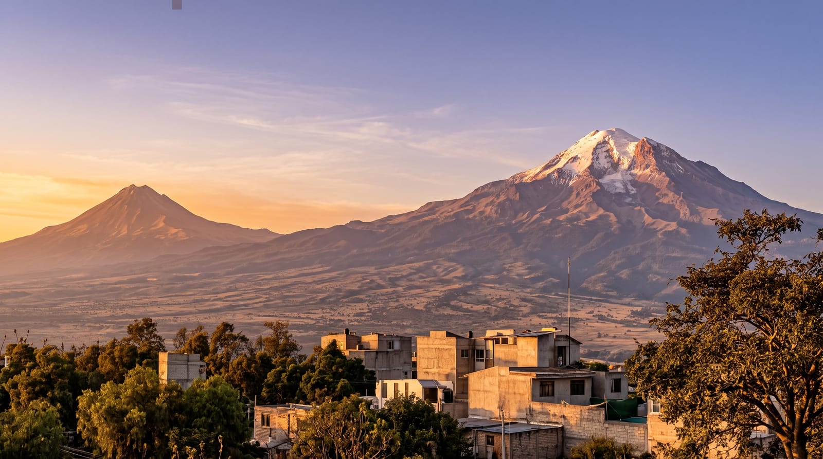
Citlaltépetl, the star mountain, stands at around five thousand six hundred metres on the border of Puebla and Veracruz, the highest point in Mexico and the third highest in North America after Denali and Logan. It is a dormant stratovolcano with a near-perfect cone and the largest glaciers left in the country, though those have retreated sharply within living memory. The standard route climbs the Jamapa glacier from the Piedra Grande hut at around four thousand two hundred metres, reached by four-wheel drive from Tlachichuca; it is not technical in good conditions but it is high, cold and long, and needs crampons, an ice axe and real acclimatisation. From the summit the Gulf of Mexico is visible on a clear morning.
History
The name Citlaltépetl means "star mountain" in Náhuatl. In the 1600s the Spanish Crown built roads around the volcano, one of which, through Orizaba and Fortín de las Flores, became the main trade route between Mexico City and Veracruz, and Spanish travellers used the peak as a landmark for the port. Henri Galeotti explored it in 1839, and in 1851 the French explorer Alejandro Doignon reached the summit (Wikipedia, Pico de Orizaba).
The landscape
- The summit crater - the rim at over five and a half thousand metres.
- The Jamapa glacier - the largest remaining ice in Mexico, and shrinking.
- Piedra Grande hut - the basic shelter at the road head, used as base.
- The cone from the plain - the classic view from the Puebla side.
When to go
November to March is the climbing season, with the most stable weather and firmest snow; the rest of the year brings storms and poor conditions. Summit days start around one in the morning. Allow several days at altitude beforehand, ideally including a climb of La Malinche or Iztaccíhuatl.
Good to know
This is a serious high-altitude climb, not a walk-up: the main dangers are falls on the glacier and ascending too fast. Go with a licensed guide unless you have real glacier experience. The hut is unheated, crowded and basic. Altitude sickness is the most common reason for turning back, and rushing from Mexico City almost guarantees it.
Nearby
Tlachichuca is the outfitting town; Puebla is two hours west.
Key facts
Source: Wikidata, item Q238147, read on 18 October 2026.
What to pack for Pico de Orizaba
Chosen from what this place is for. Tap a kit for the full checklist.
- Broken-in walking shoes or boots - Grip and ankle support matter more than looks; never hike in brand-new boots. Find on Amazon
- Warm base layers - Merino or synthetic against the skin - never cotton, which chills when damp. Find on Amazon
- Layers for big temperature swings - Warm sun by day, near-freezing at night, even near the equator. Find on Amazon
- Shelter suited to the place - Tent, tarp or hut booking - match it to the terrain and rules. Find on Amazon
Some links on this page are Amazon affiliate links - if you buy through them we may earn a small commission at no extra cost to you.
All packing kitsPlan your trip
Where to start if Pico de Orizaba is going on the list.
Booking links on this page are affiliate links - if you book through them we may earn a small commission at no extra cost to you. It never changes what we write about a place.
Opening times, ticket prices and seasonal closures change - check the official source before you go: official site.