Toktogul Reservoir
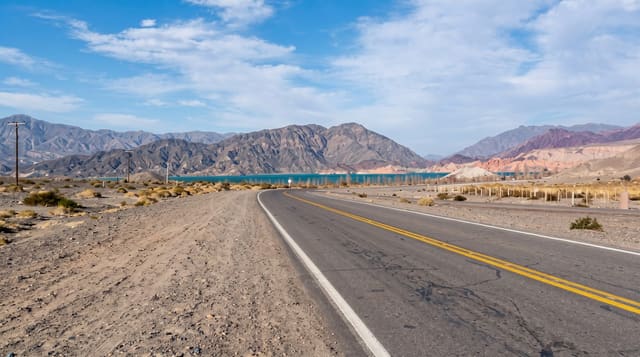
A huge turquoise reservoir on the Naryn river, passed by everyone driving between Bishkek and Osh.
Updated 21 October 2026
The Toktogul reservoir was created in the 1970s by damming the Naryn for hydroelectricity, flooding a valley; the town of Toktogul stands on the northern shore. It covers around 280 square kilometres and supplies a large share of the country's electricity, which makes its water level a national concern in dry years. For travellers it is the long turquoise sheet visible for an hour of the drive between Bishkek and Osh, with bare brown hills around it and beaches where families swim in summer. Fishing is common and roadside stands sell smoked fish. Guesthouses and simple resorts have opened along the shore. It is a stop on a long drive rather than a destination, and the contrast between the blue water and the dry hills is the whole picture.
What's there
- The turquoise reservoir - a long sheet of water below bare hills.
- The dam - the hydroelectric works at the western end.
- Shore beaches - swimming spots used by families in summer.
- Smoked fish stands - roadside sellers along the highway.
When to go
May to September for swimming and warm weather. Water levels vary a lot between years and seasons, exposing wide mud margins when low. The road over the passes at either end can close in winter storms.
Good to know
This is a working reservoir, not a lake resort: shores are bare, facilities are basic and the water level fluctuates. Swimming areas are unsupervised. The main road is busy with freight. Accommodation is simple guesthouses.
Nearby
Suusamyr valley lies northeast; Kara-Suu lake is south-east.
What to pack for Toktogul Reservoir
Chosen from what this place is for. Tap a kit for the full checklist.
- Broken-in walking shoes or boots - Grip and ankle support matter more than looks; never hike in brand-new boots. Find on Amazon
- Travel rod + reel - A packable multi-piece rod fits in a case and covers most holiday fishing. Find on Amazon
- Reef-safe sunscreen - High SPF that will not bleach the coral you are swimming over. Find on Amazon
- Layers + a waterproof shell - Mountain weather turns fast; a packable rain jacket saves the day. Find on Amazon
Some links on this page are Amazon affiliate links - if you buy through them we may earn a small commission at no extra cost to you.
All packing kitsPlan your trip
Where to start if Toktogul Reservoir is going on the list.
Booking links on this page are affiliate links - if you book through them we may earn a small commission at no extra cost to you. It never changes what we write about a place.
Opening times, ticket prices and seasonal closures change - check the official source before you go: official site.