Kara-Suu Lake
A landslide-dammed alpine lake in the mountains above Toktogul, reached by a steep walk through spruce.
Updated 12 October 2026
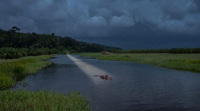
Kara-Suu sits at around 2,000 metres in the Chatkal range, formed when a landslide blocked a river valley and left a long narrow lake with drowned tree trunks standing in the shallows at one end, which is its most distinctive feature. Spruce forest comes down to the water and the slopes above are steep. Getting there means driving as far as the track allows and then walking or riding three to four hours up a valley, so it is an overnight trip rather than a day out, and camping by the shore is the usual arrangement. There is no infrastructure at all. The lake is little visited even by Kyrgyz standards, and the appeal is precisely that: forest, water and nobody, in a range that sees almost no traffic.
What's there
- The dammed lake - long narrow water held behind a landslide.
- Drowned trees - trunks standing in the shallow end.
- Spruce slopes - forest running down to the shoreline.
- Empty valley - a route with almost no other walkers.
When to go
June to September. Snow lingers into early summer at the lake and returns in October. July and August are warmest, though afternoon storms are common in the Chatkal.
Practical notes
Access requires a vehicle to the trailhead and then hours on foot or horseback with everything carried. There are no facilities, no marked trail and no signal. Local guidance is effectively necessary since the route is not obvious. Weather in the Chatkal turns quickly.
Nearby
Toktogul reservoir lies north-west; Sary-Chelek is west.
Key facts
Source: Wikidata, item Q6367472, read on 18 October 2026.
What to pack for Kara-Suu Lake
Chosen from what this place is for. Tap a kit for the full checklist.
- Broken-in walking shoes or boots - Grip and ankle support matter more than looks; never hike in brand-new boots. Find on Amazon
- Reef-safe sunscreen - High SPF that will not bleach the coral you are swimming over. Find on Amazon
- Warm base layers - Merino or synthetic against the skin - never cotton, which chills when damp. Find on Amazon
- Shelter suited to the place - Tent, tarp or hut booking - match it to the terrain and rules. Find on Amazon
Some links on this page are Amazon affiliate links - if you buy through them we may earn a small commission at no extra cost to you.
All packing kitsPlan your trip
Where to start if Kara-Suu Lake is going on the list.
Booking links on this page are affiliate links - if you book through them we may earn a small commission at no extra cost to you. It never changes what we write about a place.
Opening times, ticket prices and seasonal closures change - check the official source before you go: official site.