Tashkurgan Stone City
A ruined stone fort on the Pamir plateau, guarding a crossroads used by Silk Road caravans.
Updated 4 September 2026
AI illustration
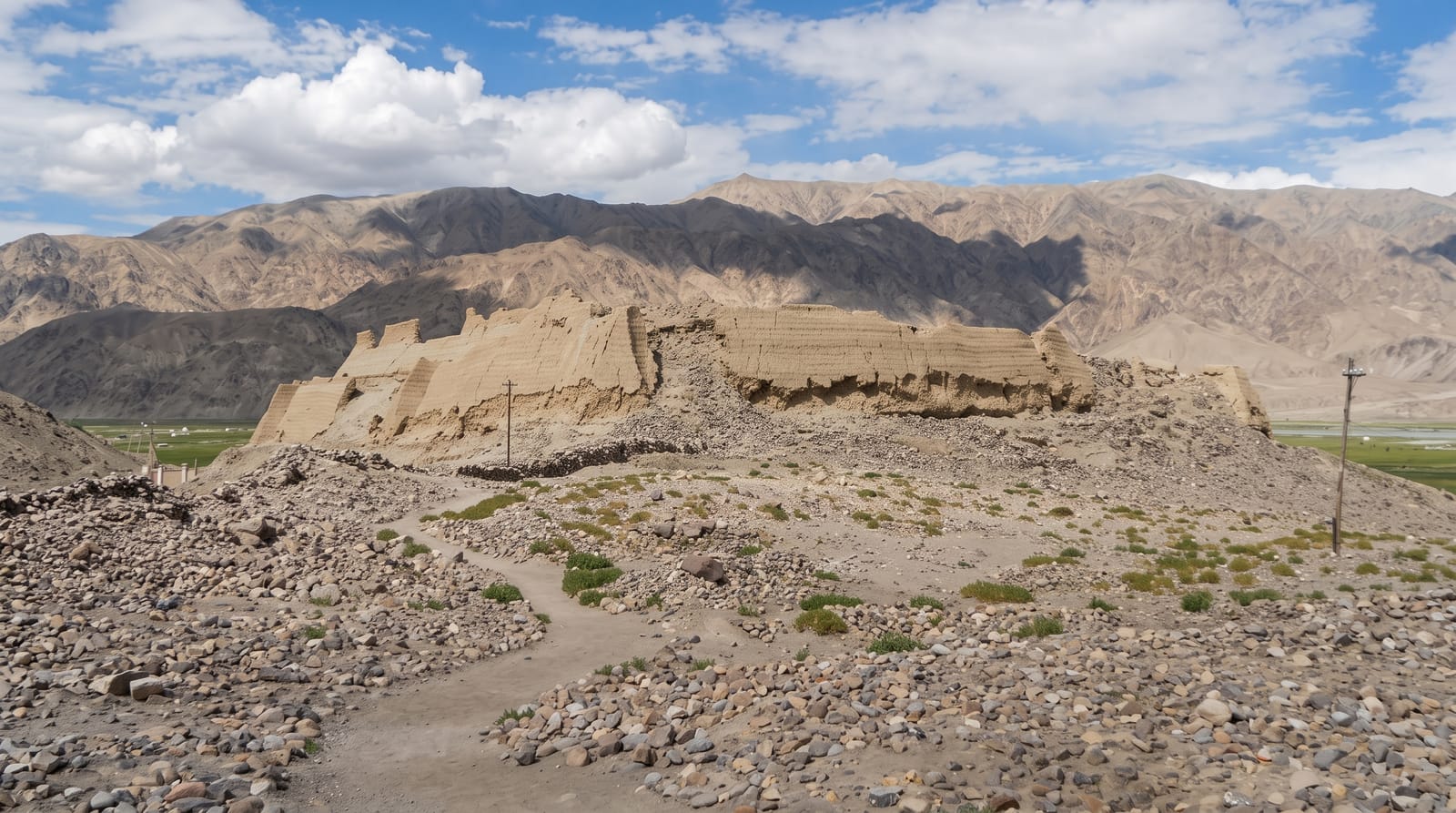
Tashkurgan means stone fort in Turkic, and the ruin the town is named for stands on a rise above it at around 3,100 metres: walls, towers and foundations of rough stone enclosing a compound, built and rebuilt over many centuries at a point where routes toward the Wakhan, Gilgit and the Tarim basin met, which made it a natural place to control traffic. Some identify it with the stone tower described by Greek geographers as a marker on the route east. Below the fort spreads a wide green wetland grazed by yaks, crossed by boardwalks, with the Pamir ranges standing white on every horizon.
What to look for
- The stone fort - walls and towers of a much-rebuilt frontier stronghold.
- The wetland below - green pasture crossed by boardwalks, grazed by yaks.
- The Pamir horizon - snow ranges surrounding the plateau town.
- The Tajik town - Sarikoli-speaking community around the ruins.
When to go
June to September, when the passes are clear and the wetland green; winter on the plateau is severe. Sunset light on the fort and wetland is the reason many stay a night.
What to expect
Altitude at 3,100 metres and the drive up from Kashgar make it a long day. The fort is ruins rather than standing architecture. Border-zone travel arrangements apply and should be checked in advance.
Nearby
Karakul Lake lies north on the highway; the Khunjerab pass is south.
Key facts
Source: Wikidata, item Q17006509, read on 18 October 2026.
What to pack for Tashkurgan Stone City
Chosen from what this place is for. Tap a kit for the full checklist.
- Warm base layers - Merino or synthetic against the skin - never cotton, which chills when damp. Find on Amazon
- Layers for big temperature swings - Warm sun by day, near-freezing at night, even near the equator. Find on Amazon
- Comfortable walking shoes - Sightseeing means kilometres of pavement and cobbles daily. Find on Amazon
- An insulated + windproof jacket - A down or synthetic layer under a hard shell handles most cold. Find on Amazon
Some links on this page are Amazon affiliate links - if you buy through them we may earn a small commission at no extra cost to you.
All packing kitsPlan your trip
Where to start if Tashkurgan Stone City is going on the list.
Booking links on this page are affiliate links - if you book through them we may earn a small commission at no extra cost to you. It never changes what we write about a place.
Opening times, ticket prices and seasonal closures change - check the official source before you go: official site.