Farwell Canyon
Ochre hoodoos and a live sand dune above a river where Tsilhqot'in families still dip-net salmon.
Updated 4 September 2026
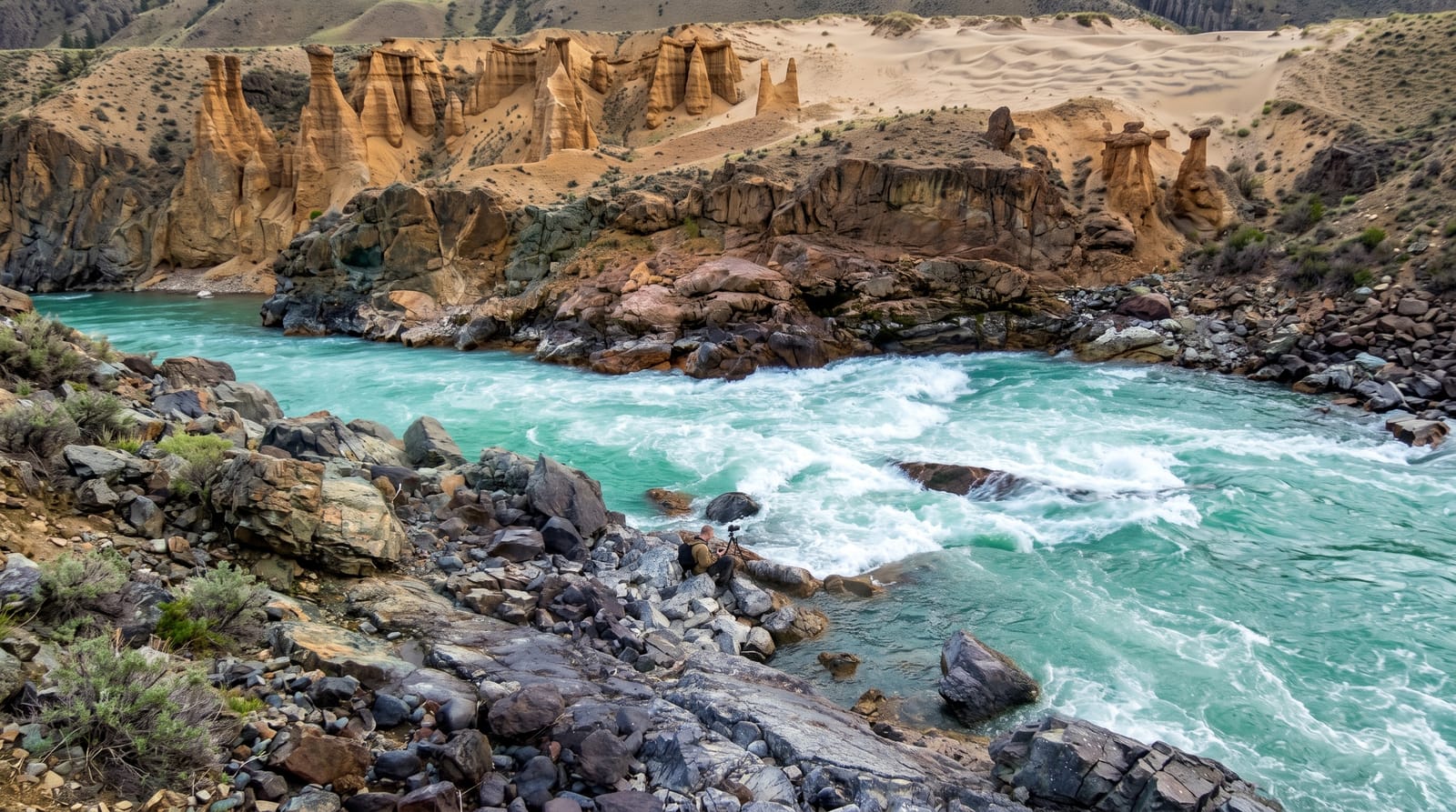
AI illustration
The Chilcotin River has cut down through soft volcanic sediment and glacial deposits, leaving banded cliffs and hoodoos in ochre, cream and rust, with a large active sand dune sliding down towards the river on one side, which is unexpected in this landscape. A single-lane bridge crosses the canyon. Tsilhqot'in families fish here as they have for generations, dip-netting and setting nets for salmon from platforms on the rock, and drying racks stand along the bank in season. California bighorn sheep live on the slopes, one of the larger herds in the province. The road in is gravel and steep on both approaches.
The landscape
- The banded hoodoos - eroded pillars in ochre and cream above the river.
- The sand dune - an active dune sliding towards the water.
- The salmon fishery - Tsilhqot'in dip-netting platforms and drying racks.
- The bighorn sheep - a large California bighorn herd on the slopes.
When to go
May to September; the road is unmaintained in winter and the descents are dangerous when icy. Salmon fishing runs in late summer. Sheep are easiest to see in spring and autumn.
Things to know
The access is steep gravel with sharp switchbacks, hard on low vehicles and dangerous when wet. The fishery is an active Indigenous food fishery, not a display, and privacy should be respected. No services of any kind.
Nearby
Williams Lake lies northeast; the Chilcotin plateau runs west.
Key facts
Source: Wikidata, item Q5436539, read on 18 October 2026.
What to pack for Farwell Canyon
Chosen from what this place is for. Tap a kit for the full checklist.
- Broken-in walking shoes or boots - Grip and ankle support matter more than looks; never hike in brand-new boots. Find on Amazon
- Travel rod + reel - A packable multi-piece rod fits in a case and covers most holiday fishing. Find on Amazon
- Loose, light, long clothing - Covering up beats bare skin in the desert - and locals dress this way for a reason. Find on Amazon
- Layers + a waterproof shell - Mountain weather turns fast; a packable rain jacket saves the day. Find on Amazon
Some links on this page are Amazon affiliate links - if you buy through them we may earn a small commission at no extra cost to you.
All packing kitsPlan your trip
Where to start if Farwell Canyon is going on the list.
Booking links on this page are affiliate links - if you book through them we may earn a small commission at no extra cost to you. It never changes what we write about a place.
Opening times, ticket prices and seasonal closures change - check the official source before you go: official site.