Valle del Lunarejo
A protected valley of ravines and native woodland in the far north, one of the wildest parts of Uruguay.
Updated 2 September 2026
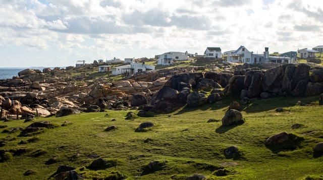
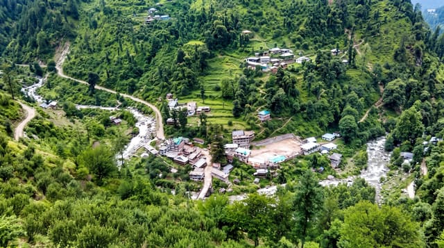
The Valle del Lunarejo cuts into the basalt plateau of northern Uruguay, a system of steep ravines and quebradas holding subtropical woodland that survives here because the slopes were too steep to clear. It is part of the national protected areas system, and the species list includes plants and animals found nowhere else in the country, carried down from Brazil along the ravines. Farms in the valley take walkers and run guided routes. The area was declared a protected landscape in 2009, and the farms inside it have kept working while opening routes to walkers, which is how most of the valley is seen.
What's there
- The quebradas - steep ravines holding subtropical woodland.
- The subtropical species - plants and animals reaching their southern limit here.
- The basalt plateau - the tableland the valley is cut into.
- The farm lodgings - working estancias in the valley taking walkers.
When to go
March to November is best for walking. Summer is hot and the ravines humid. Gravel roads are difficult after rain.
What to expect
Access roads are unsurfaced and slow. Most of the valley is private land and walking needs arrangement with the farms. There is no marked trail network.
Nearby
Tranqueras is south, and Rivera is northeast.
Key facts
Source: Wikidata, item Q16616394, read on 18 October 2026.
What to pack for Valle del Lunarejo
Chosen from what this place is for. Tap a kit for the full checklist.
- Broken-in walking shoes or boots - Grip and ankle support matter more than looks; never hike in brand-new boots. Find on Amazon
- Strong insect repellent - DEET or picaridin; the jungle is where bites and disease risk are highest. Find on Amazon
- Layers + a waterproof shell - Mountain weather turns fast; a packable rain jacket saves the day. Find on Amazon
- Long, light, quick-dry clothing - Covers skin from insects and sun without cooking you in the humidity. Find on Amazon
Some links on this page are Amazon affiliate links - if you buy through them we may earn a small commission at no extra cost to you.
All packing kitsPlan your trip
Where to start if Valle del Lunarejo is going on the list.
Booking links on this page are affiliate links - if you book through them we may earn a small commission at no extra cost to you. It never changes what we write about a place.
Opening times, ticket prices and seasonal closures change - check the official source before you go: official site.