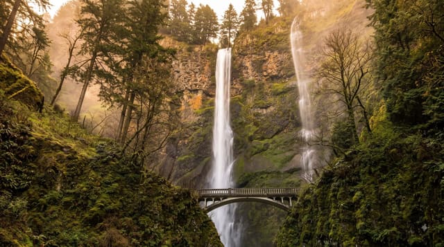
Silver Falls State Park
Oregon's largest state park, with a trail past ten waterfalls, four of which you can walk behind through basalt alcoves.
Updated 20 October 2026
The Trail of Ten Falls runs about eleven and a half kilometres through a canyon cut into Columbia River basalt, and the walk-behind falls are the reason it is unusual: the lava flows here have a hard upper layer over a softer weathered zone beneath, so the streams have hollowed out alcoves behind the curtain of water at four of the falls, and the trail goes through them. South Falls, about fifty-four metres, is the most visited; remote Double Falls is a metre higher. A National Park Service inspector rejected the area for park status in 1926 because of the stumps left by logging; in 1935 President Roosevelt made it a Recreational Demonstration Area, the logged land was bought, Civilian Conservation Corps crews built much of the trail and the South Falls Lodge, and the forest has recovered since.
Highlights
- Ten waterfalls on one loop - about eleven and a half kilometres.
- Four you walk behind - through alcoves under the basalt cap.
- South Falls at about fifty-four metres - the most visited.
- A national park rejected in the 1920s - the land was too damaged then.
When to go
March to June for flow; October to November for colour. A full day.
Practical notes
The full loop is thirteen kilometres with substantial climbing. Trails behind the falls are wet, slippery and cold with spray. Winter storms close sections. Summer weekends fill the lots by mid-morning.
Nearby
Silverton is west; the Willamette Valley wineries are north.
Key facts
Source: Wikidata, item Q1699315, read on 18 October 2026.
What to pack for Silver Falls State Park
Chosen from what this place is for. Tap a kit for the full checklist.
- Broken-in walking shoes or boots - Grip and ankle support matter more than looks; never hike in brand-new boots. Find on Amazon
- Layers + a waterproof shell - Mountain weather turns fast; a packable rain jacket saves the day. Find on Amazon
- Daypack with rain cover - 20-30 litres holds water, snacks, layers and a first-aid kit. Find on Amazon
- Offline maps + a power bank - Download the trail before you lose signal; carry backup charge. Find on Amazon
Some links on this page are Amazon affiliate links - if you buy through them we may earn a small commission at no extra cost to you.
All packing kitsPlan your trip
Where to start if Silver Falls State Park is going on the list.
Booking links on this page are affiliate links - if you book through them we may earn a small commission at no extra cost to you. It never changes what we write about a place.
Opening times, ticket prices and seasonal closures change - check the official source before you go: official site.