Phu Thap Boek
Phetchabun's highest point at about 1,768 metres, terraced in cabbages and covered in tents through the cool season.
Updated 21 October 2026
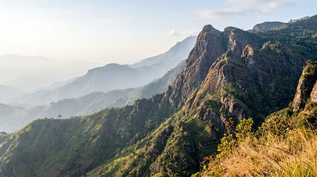
Phu Thap Boek is the highest ground in Phetchabun province at roughly 1,768 metres, and the summit ridge is farmed - Hmong villages work terraces of cabbage and other cool-climate crops right up the slopes, which is what the photographs of green stepped hillsides show. From November to February the ridge fills with tents and simple accommodation for Thai visitors who come to camp for the cold and the sunrise over cloud-filled valleys, and on peak weekends and New Year the numbers are large for a small mountain settlement, founded in 1982 as a development centre for Hmong families and surrounded by Phu Hin Rong Kla National Park. Nights fall to a few degrees and occasionally near freezing. The access road is steep with severe gradients and tight bends; local operators run pickup transfers from the bottom.
What's there
- The cabbage terraces - Hmong farming worked up the mountain slopes.
- The camping ridge - tents along the summit through the cool season.
- The sunrise - over cloud filling the valleys below.
- The altitude - about 1,768 metres, and genuinely cold at night.
When to go
November to February. New Year and cool-season weekends are extremely crowded - book ahead or go midweek. Nights are cold; bring proper warm clothing.
Before you go
The access road is steep, and local pickups run transfers. Very crowded at peak times. Cold enough at night to be a real issue for the unprepared.
Nearby
Khao Kho is south; Nam Nao National Park is east.
Key facts
Source: Wikidata, item Q15266163, read on 18 October 2026.
What to pack for Phu Thap Boek
Chosen from what this place is for. Tap a kit for the full checklist.
- Broken-in walking shoes or boots - Grip and ankle support matter more than looks; never hike in brand-new boots. Find on Amazon
- Layers for big temperature swings - Warm sun by day, near-freezing at night, even near the equator. Find on Amazon
- Shelter suited to the place - Tent, tarp or hut booking - match it to the terrain and rules. Find on Amazon
- Layers + a waterproof shell - Mountain weather turns fast; a packable rain jacket saves the day. Find on Amazon
Some links on this page are Amazon affiliate links - if you buy through them we may earn a small commission at no extra cost to you.
All packing kitsPlan your trip
Where to start if Phu Thap Boek is going on the list.
Booking links on this page are affiliate links - if you book through them we may earn a small commission at no extra cost to you. It never changes what we write about a place.
Opening times, ticket prices and seasonal closures change - check the official source before you go: official site.