Skuleskogen National Park
A High Coast park of forested hills dropping to the sea, with a rock crevice forty metres deep cut through a ridge.
Updated 16 October 2026
UNESCO World Heritage
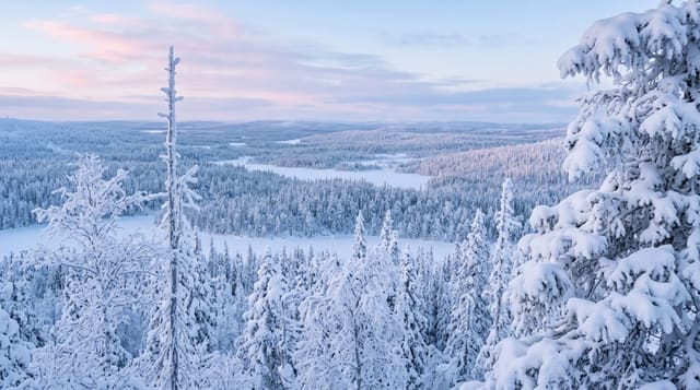
Skuleskogen sits on the High Coast, where the land has risen about 286 metres since the ice left, and some eight hundred in all since the ice sheet began to thin - the largest such rebound measured anywhere, which is why the area is on the World Heritage list. The park covers around thirty square kilometres of hills running straight down to the Bothnian sea, with old spruce and pine, boulder fields left as raised beaches at every former shoreline, and coves at the bottom. Slattdalsskrevan is the set piece: a crevice about two hundred metres long, seven wide and twenty-five deep cut straight through the rock, walkable along the bottom. Trails are steep and rocky throughout.
Background
The name means The Skule Forest, and the park takes in the eastern part of that forest, 3062 hectares in all, 282 hectares of it at sea. Its highest point, Slåttdalsberget, rises 280 metres straight out of the sea, and the ground still lifts by 8 mm per year. Bronze Age burial cairns line the ancient shoreline, and the forest later served mainly as pasture. Logging swept through in the middle of the 19th century and stopped by its end, so trees more than 100 years old now dominate. The lichen Usnea longissima is the park's emblem. Founded in 1984 and extended in 2009, the park sees 20,000 visitors per year.
Source: Wikipedia, "Skuleskogen National Park"
Highlights
- Slattdalsskrevan - a crevice two hundred metres long and forty deep.
- Raised beaches up the slopes - old shorelines left by rebound.
- Hills dropping straight to the sea - with coves at the foot.
- Old spruce and pine - across the interior.
When to go
June to September. A full day.
Practical notes
Trails involve serious climbing - this is not gentle walking. Mosquitoes are heavy in early summer. Entrances are far apart and connect only on foot. Weather off the sea changes fast.
Nearby
Skuleberget is south; Ulvon and Trysunda are offshore.
Key facts
Source: Wikidata, item Q1754183, read on 18 October 2026.
What to pack for Skuleskogen National Park
Chosen from what this place is for. Tap a kit for the full checklist.
- Broken-in walking shoes or boots - Grip and ankle support matter more than looks; never hike in brand-new boots. Find on Amazon
- Reef-safe sunscreen - High SPF that will not bleach the coral you are swimming over. Find on Amazon
- Binoculars - The single best wildlife tool - even a compact pair transforms a sighting. Find on Amazon
- Warm base layers - Merino or synthetic against the skin - never cotton, which chills when damp. Find on Amazon
Some links on this page are Amazon affiliate links - if you buy through them we may earn a small commission at no extra cost to you.
All packing kitsPlan your trip
Where to start if Skuleskogen National Park is going on the list.
Booking links on this page are affiliate links - if you book through them we may earn a small commission at no extra cost to you. It never changes what we write about a place.
Opening times, ticket prices and seasonal closures change - check the official source before you go: official site.