South Spitsbergen National Park
Svalbard's largest national park, covering the southern third of Spitsbergen.
Updated 21 October 2026
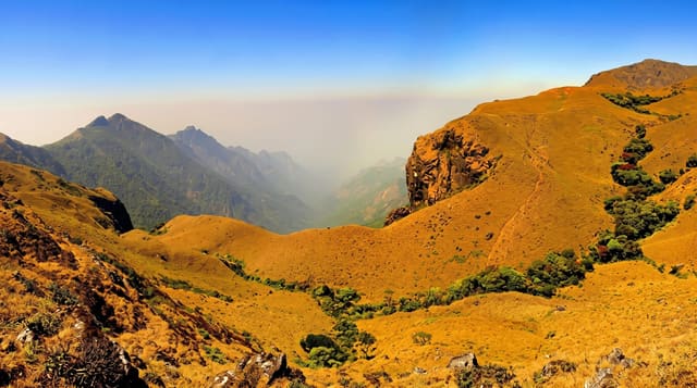
South Spitsbergen National Park covers about 13,300 square kilometres, some 5,000 of them land across the island's southern third and the rest sea, one of the largest protected areas in Svalbard, running from Hornsund down to Sørkapp and taking in glaciers, tundra plain, bird cliffs and the mountain country between. The tundra at Sørkapp is unusually rich by Svalbard standards and holds one of the archipelago's better concentrations of Svalbard reindeer. Much of the land is under permanent ice, and the bird reserves inside the park hold large colonies of Brunnich's guillemots and kittiwakes. The park was established on 1 June 1973, in the same round of designations that protected most of the archipelago's coastline, and it has been extended since.
The landscape
- The scale - around 13,300 square kilometres of land and sea, Svalbard's largest park.
- The Sørkapp tundra - unusually rich vegetation for this latitude.
- The Svalbard reindeer - the endemic subspecies concentrated on the southern plains.
- The bird cliffs - the seabird colonies along the western coast.
When to go
June to September is the practical window. Sea ice affects the southern coast into early summer. Winter access is for expeditions only.
What to expect
There is no infrastructure of any kind; this is expedition country. Polar bear protection is mandatory outside settlements. Weather and ice govern all access.
Nearby
Hornsund is within the park, and Longyearbyen is far north.
Key facts
Source: Wikidata, item Q1577229, read on 18 October 2026.
What to pack for South Spitsbergen National Park
Chosen from what this place is for. Tap a kit for the full checklist.
- Broken-in walking shoes or boots - Grip and ankle support matter more than looks; never hike in brand-new boots. Find on Amazon
- Binoculars - The single best wildlife tool - even a compact pair transforms a sighting. Find on Amazon
- Warm base layers - Merino or synthetic against the skin - never cotton, which chills when damp. Find on Amazon
- Shelter suited to the place - Tent, tarp or hut booking - match it to the terrain and rules. Find on Amazon
Some links on this page are Amazon affiliate links - if you buy through them we may earn a small commission at no extra cost to you.
All packing kitsPlan your trip
Where to start if South Spitsbergen National Park is going on the list.
Booking links on this page are affiliate links - if you book through them we may earn a small commission at no extra cost to you. It never changes what we write about a place.
Opening times, ticket prices and seasonal closures change - check the official source before you go: official site.