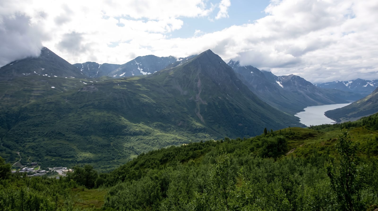
Knuckles Mountain Range
A cloud-forest range east of Kandy, one of the three components of the Central Highlands World Heritage site.
Updated 21 October 2026
UNESCO World Heritage
The Knuckles take their English name from a ridge that from Kandy looks like a clenched fist, and the range holds a compressed sequence of habitats from lowland forest through montane cloud forest to open patana grassland within a few kilometres, which is why the endemic count is so high. It is one of the three components of the Central Highlands of Sri Lanka, inscribed as World Heritage in 2010, along with Horton Plains and the Peak Wilderness.
What you'll find
- The cloud forest - montane forest hung with moss and epiphytes on the upper ridges.
- The patana grassland - open grass on the higher slopes above the tree line.
- The endemic species - amphibians, lizards and plants restricted to this range.
- The ridge profile - the knuckle-shaped crest that gives the range its name.
When to go
January to April and July to September fall between the two monsoons and are the driest. The range is wet in any month and leeches are constant. Cloud covers the ridges most afternoons.
Practical notes
Guides are compulsory on most trails and this is enforced; it is easy to get lost in cloud. Leeches are relentless and socks are essential. Access roads are rough and slow.
Nearby
Riverston is on the northern edge, and Meemure is deep inside the range.
Key facts
Source: Wikidata, item Q3531488, read on 18 October 2026.
What to pack for Knuckles Mountain Range
Chosen from what this place is for. Tap a kit for the full checklist.
- Broken-in walking shoes or boots - Grip and ankle support matter more than looks; never hike in brand-new boots. Find on Amazon
- Strong insect repellent - DEET or picaridin; the jungle is where bites and disease risk are highest. Find on Amazon
- Layers + a waterproof shell - Mountain weather turns fast; a packable rain jacket saves the day. Find on Amazon
- Long, light, quick-dry clothing - Covers skin from insects and sun without cooking you in the humidity. Find on Amazon
Some links on this page are Amazon affiliate links - if you buy through them we may earn a small commission at no extra cost to you.
All packing kitsPlan your trip
Where to start if Knuckles Mountain Range is going on the list.
Booking links on this page are affiliate links - if you book through them we may earn a small commission at no extra cost to you. It never changes what we write about a place.
Opening times, ticket prices and seasonal closures change - check the official source before you go: official site.