Tablas de Daimiel
A wetland national park in La Mancha where two rivers spread into shallow tables of water, threatened by aquifer depletion.
Updated 4 September 2026
AI illustration
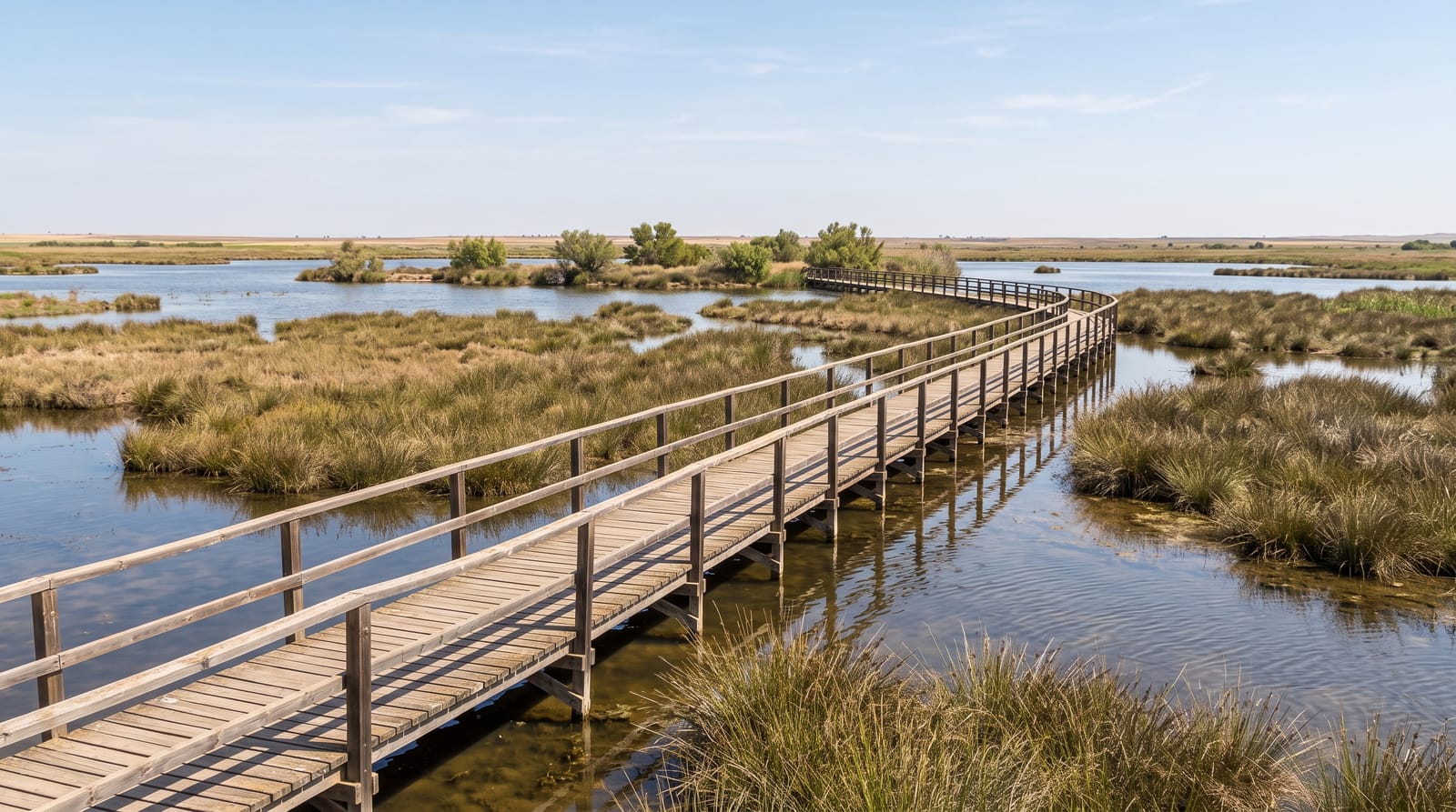
The Tablas form where the Guadiana and the Ciguela overflow their banks across a flat plain, creating shallow sheets of water among reed and cut sedge, a habitat once widespread on the Mancha plain and now almost gone. It became a national park in 1973 and holds large numbers of wintering ducks, along with herons, marsh harriers, grebes and, when conditions allow, breeding waterbirds. The park's problem is water: the aquifer beneath has been drawn down heavily for irrigation over decades, and the wetland has repeatedly dried out, at times almost entirely, requiring emergency transfers from other basins. Boardwalks and hides run through a small accessible section from the visitor centre.
Highlights
- The shallow tables - sheets of water spreading among reed beds.
- The wintering ducks - large flocks from autumn through winter.
- The boardwalk route - a short accessible circuit with hides.
- The water crisis - visible evidence of drying and aquifer depletion.
When to go
November to April, when water levels are highest and wintering birds are present; summer often finds the wetland reduced or dry. Checking the park's water situation before travelling is genuinely worthwhile.
Good to know
The park has been dry or nearly dry in several recent years, and a visit can find bare cracked mud instead of wetland. The accessible area is small, a couple of kilometres of boardwalk. Facilities are limited to the visitor centre.
Nearby
Daimiel town is close; Almagro and Ciudad Real lie southwest.
Key facts
Source: Wikidata, item Q1520216, read on 18 October 2026.
What to pack for Tablas de Daimiel
Chosen from what this place is for. Tap a kit for the full checklist.
- Broken-in walking shoes or boots - Grip and ankle support matter more than looks; never hike in brand-new boots. Find on Amazon
- Binoculars - The single best wildlife tool - even a compact pair transforms a sighting. Find on Amazon
- Layers + a waterproof shell - Mountain weather turns fast; a packable rain jacket saves the day. Find on Amazon
- A zoom camera or long lens - Animals rarely come close; reach beats megapixels. Find on Amazon
Some links on this page are Amazon affiliate links - if you buy through them we may earn a small commission at no extra cost to you.
All packing kitsPlan your trip
Where to start if Tablas de Daimiel is going on the list.
Booking links on this page are affiliate links - if you book through them we may earn a small commission at no extra cost to you. It never changes what we write about a place.
Opening times, ticket prices and seasonal closures change - check the official source before you go: official site.