Tolbachik Volcano
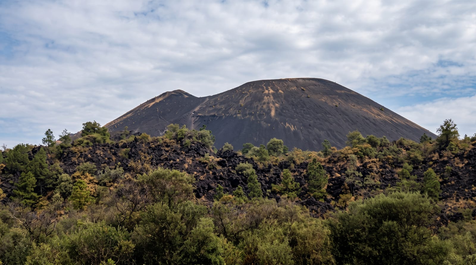
Black lava fields and cinder cones from the 1975 and 2012 eruptions, used to test lunar rovers before they were sent to the Moon.
Updated 21 October 2026
Tolbachik is a pair of volcanoes at the southern end of the Klyuchevskaya group - Ostry, sharp and extinct at 3,672 metres, and Ploskiy, flat and active at 3,085 - and what people come for is the ground around them. The Great Tolbachik Fissure Eruption of 1975 to 1976 was one of the largest basaltic eruptions of the twentieth century, throwing up new cinder cones and burying a huge area under black ash and lava, and a second eruption in 2012 to 2013 added more, with lava flows that ran through and destroyed the volcanological field station. The result is square kilometres of black cinder desert, cones, lava tubes and a Dead Forest of ash-buried tree trunks. Because it looked like the Moon, Soviet engineers brought the Lunokhod prototypes here in the late 1960s to test them, which is a real piece of history rather than a marketing line. Access is off-road from Kozyrevsk.
The landscape
- The black fields - square kilometres of cinder and lava from 1975 and 2012.
- The cones - new cinder cones thrown up by the fissure eruptions.
- The Dead Forest - ash-buried tree trunks standing in the cinder.
- The Lunokhod tests - Soviet lunar rover prototypes trialled here in the 1960s.
When to go
July to September; snow closes the tracks otherwise. Three days to a week. Off-road transfers from Kozyrevsk must be arranged.
Things to know
Access is a long off-road drive with no services. Cinder underfoot is hard walking and destroys footwear. Lava tubes need lights and care. Weather at altitude on an exposed field is severe. Bears are present.
Nearby
Klyuchevskaya Sopka is north in the same group; Kozyrevsk is the access town.
Key facts
Source: Wikidata, item Q48784, read on 18 October 2026.
What to pack for Tolbachik Volcano
Chosen from what this place is for. Tap a kit for the full checklist.
- Broken-in walking shoes or boots - Grip and ankle support matter more than looks; never hike in brand-new boots. Find on Amazon
- Head torch + spare batteries - Hands-free light is essential; caves are truly dark. Find on Amazon
- Warm base layers - Merino or synthetic against the skin - never cotton, which chills when damp. Find on Amazon
- Loose, light, long clothing - Covering up beats bare skin in the desert - and locals dress this way for a reason. Find on Amazon
Some links on this page are Amazon affiliate links - if you buy through them we may earn a small commission at no extra cost to you.
All packing kitsPlan your trip
Where to start if Tolbachik Volcano is going on the list.
Booking links on this page are affiliate links - if you book through them we may earn a small commission at no extra cost to you. It never changes what we write about a place.
Opening times, ticket prices and seasonal closures change - check the official source before you go: official site.