Transalpina
The highest road in Romania, crossing the Parâng mountains at over two thousand metres on open alpine pasture.
Updated 22 October 2026
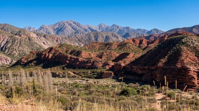
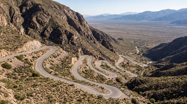
The Transalpina runs north to south over the Parâng range, topping out at the Urdele pass at around 2,145 metres, which makes it the highest road in the country. Its character is quite different from the Transfăgărășan: instead of cliffs and tunnels, it climbs onto wide open pasture, so for kilometres the road runs along rounded ridges with grazing sheep, shepherds' huts and enormous views on both sides. The route is old, used for centuries as a droving track and improved at various points, and it was fully asphalted in the 2010s. Sections near the top are exposed with no barriers and steep drops, and weather can close it at any time from autumn onward. Ranca on the southern side has grown into a small resort, and there are pull-offs, food stalls and cabins along the way, though services thin out on the high sections.
History
The route began as a mountain path, the Devil's Path, used by shepherds of the Mărginimea Sibiului to drive their flocks into Wallachia, and as early as 1731 the Austrian authorities proposed a road along the old transhumance route. Work to turn it into a modern 148 km road began in 2008-2009; it is the highest road in Romania, crossing the Urdele Pass at 2,145 m (Wikipedia, Transalpina (DN67C)).
What's there
- The Urdele pass - the high point at around 2,145 metres.
- Open ridge driving - long stretches across grazed alpine pasture.
- Shepherds and flocks - working sheepfolds beside the road in summer.
- Ranca - the small resort on the southern approach.
When to go
June to October; the road officially closes for winter and is not maintained over the pass. July and August are busiest and the high sections can be a slow procession. Early morning gives the clearest air and the best chance of empty road.
Before you go
Weather at the top changes fast and fog can reduce visibility to nothing within minutes. There are no barriers on some exposed bends. Livestock on the road is constant and dogs guarding flocks will approach vehicles. Fuel and food are scarce on the high section, so fill up before starting. Motorhomes and caravans struggle on the gradients.
Nearby
Polovragi and Novaci are at the southern foot; Sebeș and Alba Iulia lie north.
Key facts
Source: Wikidata, item Q3123382, read on 18 October 2026.
What to pack for Transalpina
Chosen from what this place is for. Tap a kit for the full checklist.
- Comfortable walking shoes - Sightseeing means kilometres of pavement and cobbles daily. Find on Amazon
- Shelter suited to the place - Tent, tarp or hut booking - match it to the terrain and rules. Find on Amazon
- A slim anti-theft daypack - Zips that close properly; keep it in front in crowds and on transit. Find on Amazon
- A warm sleeping bag + mat - Rated a little colder than you expect the nights to be. Find on Amazon
Some links on this page are Amazon affiliate links - if you buy through them we may earn a small commission at no extra cost to you.
All packing kitsPlan your trip
Where to start if Transalpina is going on the list.
Booking links on this page are affiliate links - if you book through them we may earn a small commission at no extra cost to you. It never changes what we write about a place.
Opening times, ticket prices and seasonal closures change - check the official source before you go: official site.