Mont Nabemba
The highest point in the Republic of the Congo, a forested hill in the far north.
Updated 21 October 2026
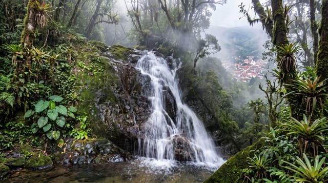
Mont Nabemba rises to 1,020 metres in the far north of the Republic of the Congo, about fifty kilometres from Souanké near the Cameroonian border, the highest point in the country, an isolated forested massif standing above the surrounding lowland forest. Iron ore deposits in and around it have been surveyed repeatedly. The name was given to Brazzaville's tallest building. Climbing it means forest walking with guides from the villages at its foot.
What's there
- The summit - 1,020 metres, the highest point in the country.
- The isolated massif - a hill standing above the surrounding lowland forest.
- The forest cover - dense woodland running up the slopes.
- The name - the mountain that Brazzaville's tallest tower was named after.
When to go
June to September is the drier season and the practical window. The forest is wet year round. Rain makes the approach very difficult.
Practical notes
There is no trail and guides from the villages are essential. The summit is forested with limited view. The far north is remote and access takes days.
Nearby
Ouesso is south, and the Cameroon border is north.
Key facts
Source: Wikidata, item Q3113296, read on 18 October 2026.
What to pack for Mont Nabemba
Chosen from what this place is for. Tap a kit for the full checklist.
- Broken-in walking shoes or boots - Grip and ankle support matter more than looks; never hike in brand-new boots. Find on Amazon
- Layers for big temperature swings - Warm sun by day, near-freezing at night, even near the equator. Find on Amazon
- Layers + a waterproof shell - Mountain weather turns fast; a packable rain jacket saves the day. Find on Amazon
- Extra-strong sun protection - Thin air means fierce UV; hat, sunglasses and high-SPF sunscreen. Find on Amazon
Some links on this page are Amazon affiliate links - if you buy through them we may earn a small commission at no extra cost to you.
All packing kitsPlan your trip
Where to start if Mont Nabemba is going on the list.
Booking links on this page are affiliate links - if you book through them we may earn a small commission at no extra cost to you. It never changes what we write about a place.
Opening times, ticket prices and seasonal closures change - check the official source before you go: official site.