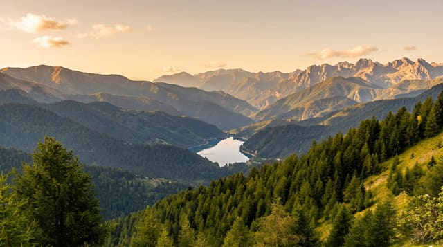
Salinas y Aguada Blanca National Reserve
High puna above Arequipa with vicuña herds, a seasonal salt lake and three volcanoes standing over the plateau.
Updated 21 October 2026
Everyone driving from Arequipa to the Colca canyon or to Puno crosses this reserve, usually without registering that they have. It covers high puna between roughly 3,700 and 6,000 metres, taking in the volcanoes Misti, Chachani and Pichu Pichu and the wide shallow basin of the Laguna de Salinas. The lake is salt and seasonal: full and busy with flamingos after the rains, then a white crust worked by hand in the dry months. Vicuña herds graze the grassland along the road and are easy to see, along with viscachas among the rocks, Andean geese and stands of queñua, a tree that grows higher than almost any other.
History
The area was declared a national reserve on 9 August 1979, and Lake Salinas and Lake Del Indio inside it were designated Ramsar sites in 2003 (Wikipedia, Salinas y Aguada Blanca National Reserve).
Highlights
- Vicuña herds - wild vicuña grazing the puna, regularly visible from the road itself.
- Laguna de Salinas - a salt basin holding flamingos after rain and worked for salt when dry.
- Misti, Chachani and Pichu Pichu - the three volcanoes standing over the reserve.
- Queñua woodland - high-altitude trees growing near the upper limit for any tree at all.
When to go
January to April fills the lake and brings the flamingos, but the roads are wetter and the passes harder. May to November is dry and clear, with hard frosts at night and the lake reduced to salt crust. Most people see the reserve as a stop on the Colca or Puno road, which works if the driver is willing to pull over.
Before you go
Seen from a tour bus this is a series of brief photo stops on a cold roadside, and the flamingos are often distant specks that need binoculars. The road crosses passes above 4,000 metres and altitude sickness catches people out on the way to Colca. Wind and cold are constant. The salt lake is dry and unremarkable for much of the year.
Nearby
The Colca canyon lies north along the same road, and Arequipa is under two hours south.
Key facts
Source: Wikidata, item Q3457287, read on 18 October 2026.
What to pack for Salinas y Aguada Blanca National Reserve
Chosen from what this place is for. Tap a kit for the full checklist.
- Broken-in walking shoes or boots - Grip and ankle support matter more than looks; never hike in brand-new boots. Find on Amazon
- Binoculars - The single best wildlife tool - even a compact pair transforms a sighting. Find on Amazon
- Layers for big temperature swings - Warm sun by day, near-freezing at night, even near the equator. Find on Amazon
- Layers + a waterproof shell - Mountain weather turns fast; a packable rain jacket saves the day. Find on Amazon
Some links on this page are Amazon affiliate links - if you buy through them we may earn a small commission at no extra cost to you.
All packing kitsPlan your trip
Where to start if Salinas y Aguada Blanca National Reserve is going on the list.
Booking links on this page are affiliate links - if you book through them we may earn a small commission at no extra cost to you. It never changes what we write about a place.
Opening times, ticket prices and seasonal closures change - check the official source before you go: official site.