Chitral
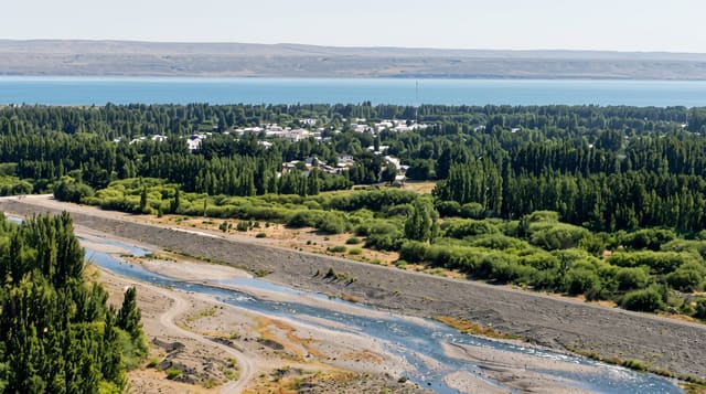
A Hindu Kush town under the 7,708-metre Tirich Mir, with a riverside fort, a mosque of pale stone and a polo ground.
Updated 21 October 2026
Chitral town sits on the Chitral river with Tirich Mir, the highest peak of the Hindu Kush at 7,708 metres, standing directly above it on clear days. The town was the seat of a princely state until 1969, and the Chitral Fort, a mud-brick and timber structure of the 1890s, still belongs to the former ruling family beside the water. Next to it the Shahi Masjid, built in 1924, is faced in pale stone with white domes and is the town's most photographed building. The bazaar sells Chitrali woollen caps and shu cloth, and the summer polo season culminates in matches at the town ground before the teams head for Shandur. Chitrali is spoken here, quite distinct from Pashto, and the valley's music, with sitar and drums, is a living tradition. The Lowari tunnel, opened to traffic in the 2010s, ended the winter isolation that once cut the district off for months.
History
Graves of the Gandharan Grave Culture are scattered through the valleys, and in the 2nd century CE the Chitral Valley was part of the Kushan Empire under Kanishka. The Raís dynasty ruled Chitral from 1320 until the 15th century, and from 1571 it was the capital of a kingdom under the Katūr dynasty; the name means "field" in Khowar (Wikipedia, Chitral).
The main sights
- Chitral Fort - the riverside mud-brick fort of the former rulers.
- Shahi Masjid - the pale stone mosque with white domes beside it.
- Tirich Mir - the Hindu Kush summit visible above the town.
- The bazaar - Chitrali caps, shu woollen cloth and local crafts.
When to go
April to October. Spring blossom and autumn colour are both good, and the polo season runs through summer. Flights are frequently cancelled for weather, so the road through the Lowari tunnel is the reliable option, taking most of a day from Islamabad.
Practical notes
The fort is privately owned and access is not guaranteed; ask locally. Flights are notoriously unreliable and travellers should plan the road as the default. The town itself is small and workaday, with the interest lying in its position and the valleys around. Hotel standards are basic.
Nearby
The Kalash valleys lie south; Garam Chashma is up a side valley northwest.
Key facts
Source: Wikidata, item Q12126543, read on 18 October 2026.
What to pack for Chitral
Chosen from what this place is for. Tap a kit for the full checklist.
- Comfortable walking shoes - Sightseeing means kilometres of pavement and cobbles daily. Find on Amazon
- Modest clothing - Shoulders and knees covered - the single most common requirement. Find on Amazon
- A slim anti-theft daypack - Zips that close properly; keep it in front in crowds and on transit. Find on Amazon
- A scarf or shawl - To cover the head or shoulders on entry; women especially at mosques. Find on Amazon
Some links on this page are Amazon affiliate links - if you buy through them we may earn a small commission at no extra cost to you.
All packing kitsPlan your trip
Where to start if Chitral is going on the list.
Booking links on this page are affiliate links - if you book through them we may earn a small commission at no extra cost to you. It never changes what we write about a place.
Opening times, ticket prices and seasonal closures change - check the official source before you go: official site.