Magdalenefjorden
A glacier-ringed fjord on northwest Spitsbergen used as an anchorage by whalers and expeditions for four centuries.
Updated 21 October 2026

AI illustration
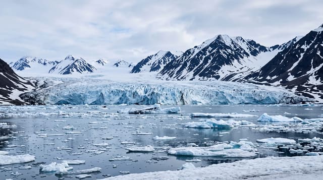
Magdalenefjorden cuts about eight kilometres into the northwest corner of Spitsbergen, ringed by steep peaks and several glacier fronts that calve into it, and its sheltered water made it one of the most used anchorages in the Arctic from the seventeenth century onward. English and Dutch whalers worked here from the 1600s, and at Gravneset, a low spit at the fjord mouth, lie around a hundred and thirty graves of whalers buried in the permafrost, now a protected site with strict rules about where visitors may walk. Later polar expeditions used the fjord as a staging point. Today it is a standard landing on expedition cruises around Svalbard, with polar bear watch maintained ashore.
History
William Barents explored the fjord in 1596 and called it Tusk Bay after the walrus tusks he found. The English whaler Robert Fotherby entered it in 1614, claimed it for King James I and named it Maudlen Sound, and the English set up a whaling station in Trinity Harbor on what is now Gravneset, where the remains of four blubber ovens survive; the Dutch Abraham Goos called it Magdalenen sond in 1620 (Wikipedia, Magdalenefjorden).
What you'll find
- The calving glaciers - ice fronts dropping into the fjord.
- Gravneset - a protected whalers' burial ground on the spit.
- The peaks - steep mountains enclosing the fjord on both sides.
- The Arctic wildlife - seals, seabirds and, occasionally, polar bears.
When to go
June to August, the operating season for expedition ships; sea ice can block access early in the season and conditions vary year to year. The midnight sun runs from April to late August.
Before you go
Access is only by expedition cruise, which is expensive and books far ahead. Landings depend entirely on ice, weather and bear activity and are cancelled without notice. Walking is restricted to protect the graves and the fragile tundra, and armed guides are mandatory ashore.
Nearby
Ny-Alesund and the Kongsfjorden lie south; Longyearbyen is the main settlement and gateway.
Key facts
Source: Wikidata, item Q1324045, read on 18 October 2026.
What to pack for Magdalenefjorden
Chosen from what this place is for. Tap a kit for the full checklist.
- Broken-in walking shoes or boots - Grip and ankle support matter more than looks; never hike in brand-new boots. Find on Amazon
- Binoculars - The single best wildlife tool - even a compact pair transforms a sighting. Find on Amazon
- Spare batteries + cards - Cold and long shoots drain power; never run out at the good light. Find on Amazon
- Warm base layers - Merino or synthetic against the skin - never cotton, which chills when damp. Find on Amazon
Some links on this page are Amazon affiliate links - if you buy through them we may earn a small commission at no extra cost to you.
All packing kitsPlan your trip
Where to start if Magdalenefjorden is going on the list.
Booking links on this page are affiliate links - if you book through them we may earn a small commission at no extra cost to you. It never changes what we write about a place.
Opening times, ticket prices and seasonal closures change - check the official source before you go: official site.