The Chimanimani Mountains
Mozambique's rooftop - quartzite peaks around 2,436-metre Monte Binga, cedar valleys, rock art and trekking on the wild side of the border range.
Updated 7 August 2026

AI illustration
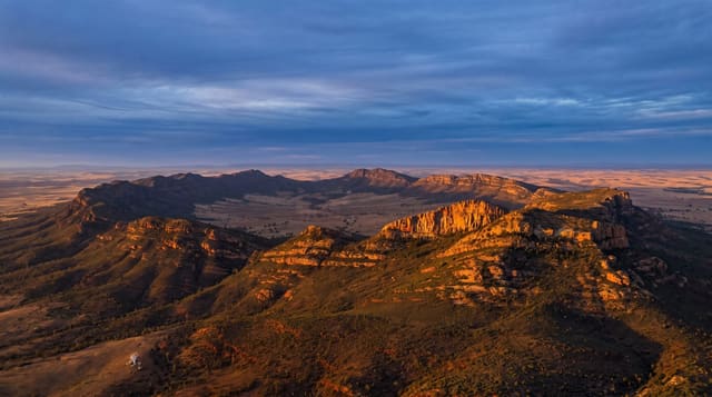
The Chimanimani range piles white quartzite into Mozambique's highest country, crowned by Monte Binga at about 2,436 metres - the national summit - and folded into valleys where cedar and tree ferns crowd mountain streams. The Mozambican side is the wilder half of a transboundary conservation area: trails climb from lowland forest through protea slopes to summit ridges, San rock art marks overhang shelters, and treks run village-guided with camps by waterfall pools. It is hiking country of the honest kind - carried packs, river crossings, weather with opinions - and it sees a fraction of the visitors its scenery argues for.
Highlights
- Monte Binga - the national summit's quartzite pyramid.
- The cedar valleys - streams, tree ferns and forest birdlife.
- San rock art - painted shelters along the old paths.
- Waterfall pools - swimming camps on the trekking routes.
When to go
May to October gives dry trails and clear summit odds; Binga's top makes its own cloud regardless - start summit days at first light. The rains swell rivers and close crossings.
What to expect
Logistics are self-assembled: park fees and local guides arranged at the gate, gear carried or hired, and no rescue infrastructure to speak of - competence and margins matter. Paths are rough and river stones slick. The reward structure favours those who like their mountains empty and their evenings by a fire.
Nearby
Chimoio's markets, the Vumba's border hills and the road east toward the coast.
What to pack for The Chimanimani Mountains
Chosen from what this place is for. Tap a kit for the full checklist.
- Broken-in walking shoes or boots - Grip and ankle support matter more than looks; never hike in brand-new boots. Find on Amazon
- Reef-safe sunscreen - High SPF that will not bleach the coral you are swimming over. Find on Amazon
- Binoculars - The single best wildlife tool - even a compact pair transforms a sighting. Find on Amazon
- Layers for big temperature swings - Warm sun by day, near-freezing at night, even near the equator. Find on Amazon
Some links on this page are Amazon affiliate links - if you buy through them we may earn a small commission at no extra cost to you.
All packing kitsPlan your trip
Where to start if The Chimanimani Mountains is going on the list.
Booking links on this page are affiliate links - if you book through them we may earn a small commission at no extra cost to you. It never changes what we write about a place.
Opening times, ticket prices and seasonal closures change - check the official source before you go: official site.