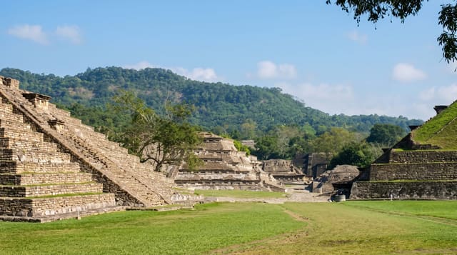
Ksar es-Seghir
A small walled port on the strait, excavated to show a Muslim town and the Portuguese fort built inside it.
Updated 20 October 2026
Ksar es-Seghir sits at the narrowest usable crossing of the strait and was the port from which armies and pilgrims went to and from Spain for centuries; it was walled by the Marinids in 1287, taken by the Portuguese in 1458 and held until 1550, and abandoned afterwards - which is why the archaeology is unusually clean. Excavations, largely American-led from the 1970s, exposed the whole walled circuit, roughly circular with three gates, and inside it the street plan of the Islamic town with houses, a bath and a mosque, and then the smaller Portuguese fort built within the same walls when the garrison shrank, cutting across the earlier layout. Seeing the two phases superimposed on one site is the point. It is unfenced and unstaffed, on the shore beside the modern village, with the strait and Spain visible from the walls.
History
The town was probably first a Phoenician colony, Exilissa, and under the Romans a fish-salting post. Under the Almoravids and Almohads it was a major shipyard and the port where travellers embarked for Spain, and in 1287 the Marinid sultan Abu Yaqub Yusuf gave the circular town new thick walls with 29 bastions and three gates, Bab al-Bahr, Bab Sebta and Bab Fes (Wikipedia, Ksar es-Seghir).
What's there
- Two towns on one plan - the Islamic street layout with a Portuguese fort cut into it.
- A complete walled circuit - roughly circular with three gates, fully exposed.
- Houses, bath and mosque - excavated foundations of the Muslim town.
- The strait from the walls - Spain visible across the narrowest usable crossing.
When to go
Spring and autumn. An hour.
Before you go
There is no signage, staff or facility of any kind - without background the foundations are hard to read. The site is unfenced and lightly maintained. It is a short stop, not a half-day. Wind on the shore is constant.
Nearby
Cap Malabata is west; Ceuta is east along the coast.
What to pack for Ksar es-Seghir
Chosen from what this place is for. Tap a kit for the full checklist.
- Comfortable walking shoes - Sightseeing means kilometres of pavement and cobbles daily. Find on Amazon
- Modest clothing - Shoulders and knees covered - the single most common requirement. Find on Amazon
- A slim anti-theft daypack - Zips that close properly; keep it in front in crowds and on transit. Find on Amazon
- A scarf or shawl - To cover the head or shoulders on entry; women especially at mosques. Find on Amazon
Some links on this page are Amazon affiliate links - if you buy through them we may earn a small commission at no extra cost to you.
All packing kitsPlan your trip
Where to start if Ksar es-Seghir is going on the list.
Booking links on this page are affiliate links - if you book through them we may earn a small commission at no extra cost to you. It never changes what we write about a place.
Opening times, ticket prices and seasonal closures change - check the official source before you go: official site.