Jebel Tidighine
The highest summit of the Rif at 2,456 metres, snow-covered in winter and reached by rough piste from Ketama.
Updated 29 August 2026
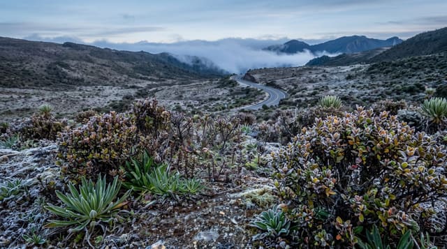
Tidighine, sometimes written Tidirhine, is the high point of the whole Rif chain at 2,456 metres, a bare rounded summit rising above cedar and Moroccan fir forest in the central range. It holds snow through winter and into spring, which is unusual this far north in Morocco and gives the range its water. The forest below the summit is significant: Abies marocana, the Moroccan fir, is endemic to these mountains and grows nowhere else, and the stands here and in Talassemtane are what remain of it. Views from the top run to the Mediterranean on one side and across the Rif ridges on the other. The practical difficulty is access - the approach is by rough piste through the Ketama district, which is the centre of cannabis cultivation in Morocco, so going with a local guide arranged in advance rather than driving in unannounced is the sensible approach.
What you'll find
- The Rif's high point - 2,456 metres, snow-held through winter and spring.
- Moroccan fir - a species endemic to these mountains and nowhere else.
- Two-sea views - the Mediterranean on one side, Rif ridges on the other.
- Cedar forest below - the belt the piste climbs through to the summit.
When to go
May to October; snow closes the piste in winter. A day.
Things to know
Access is by rough piste and needs high clearance. The surrounding district is the centre of cannabis growing and arriving unannounced is unwise - arrange a local guide in advance. There are no facilities on the mountain. Weather at the summit changes fast.
Nearby
Al Hoceima is north; Chefchaouen is west along the range.
What to pack for Jebel Tidighine
Chosen from what this place is for. Tap a kit for the full checklist.
- Broken-in walking shoes or boots - Grip and ankle support matter more than looks; never hike in brand-new boots. Find on Amazon
- Warm base layers - Merino or synthetic against the skin - never cotton, which chills when damp. Find on Amazon
- Layers for big temperature swings - Warm sun by day, near-freezing at night, even near the equator. Find on Amazon
- Layers + a waterproof shell - Mountain weather turns fast; a packable rain jacket saves the day. Find on Amazon
Some links on this page are Amazon affiliate links - if you buy through them we may earn a small commission at no extra cost to you.
All packing kitsPlan your trip
Where to start if Jebel Tidighine is going on the list.
Booking links on this page are affiliate links - if you book through them we may earn a small commission at no extra cost to you. It never changes what we write about a place.
Opening times, ticket prices and seasonal closures change - check the official source before you go: official site.