Ol Donyo Sabuk National Park
A forested mountain rising alone from the plains east of Thika, with buffalo on its slopes and a drivable summit road.
Updated 20 October 2026
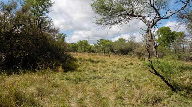
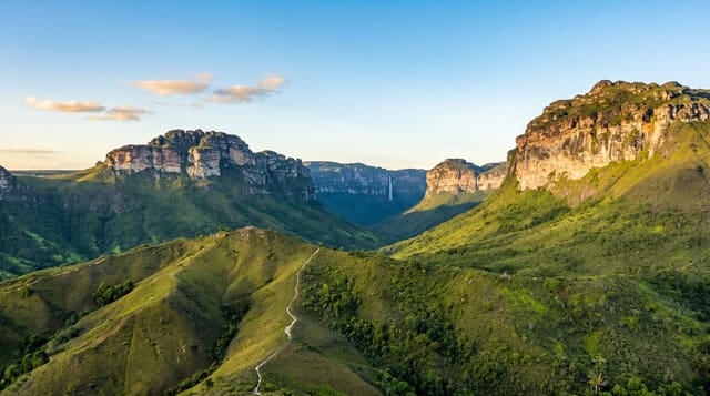
Ol Donyo Sabuk is a small park wrapped around a single mountain, called Kilima Mbogo in Swahili, the buffalo mountain, and the name is accurate: the forest holds a substantial buffalo population, which is the main reason visitors are told not to walk unaccompanied. The mountain rises to just over 2,100 metres from surrounding plains, and a rough track climbs to the summit through changing vegetation, from dry bush at the base into montane forest with orchids and moss higher up. From the top the view runs to Mount Kenya on a clear morning, over the Athi plains and back towards Nairobi. Halfway up lie the graves of Sir William Northrup McMillan, an American settler who owned the estate here, and his wife. Colobus monkeys, bushbuck and a good bird list share the forest with the buffalo.
History
The Maasai name means "big mountain", the Kamba name, Kyanzavi, means "mountain of lablab beans", and the Swahili Kilimambogo means "buffalo mountain", after the many buffalo in its forest (Wikipedia, Ol Donyo Sabuk).
What you'll find
- The summit track - a rough drive through changing forest to the top.
- Buffalo - the mountain's namesake, common in the forest.
- The summit view - Mount Kenya and the Athi plains on clear mornings.
- The McMillan graves - the settler burial site partway up.
When to go
The dry seasons for a passable track; the road becomes impossible in the rains. Early morning gives the clearest chance of seeing Mount Kenya from the top before haze builds. It works as a half-day from Nairobi combined with Fourteen Falls.
Before you go
Walking is restricted because of buffalo, and a ranger escort is required for hiking, so most visits are a drive up and back. The summit track needs 4x4 and is rough. Views are frequently hazed out. Facilities are minimal.
Nearby
Fourteen Falls is adjacent; Thika and the Nairobi road lie west.
Key facts
Source: Wikidata, item Q3695222, read on 18 October 2026.
What to pack for Ol Donyo Sabuk National Park
Chosen from what this place is for. Tap a kit for the full checklist.
- Broken-in walking shoes or boots - Grip and ankle support matter more than looks; never hike in brand-new boots. Find on Amazon
- Binoculars - The single best wildlife tool - even a compact pair transforms a sighting. Find on Amazon
- Layers + a waterproof shell - Mountain weather turns fast; a packable rain jacket saves the day. Find on Amazon
- A zoom camera or long lens - Animals rarely come close; reach beats megapixels. Find on Amazon
Some links on this page are Amazon affiliate links - if you buy through them we may earn a small commission at no extra cost to you.
All packing kitsPlan your trip
Where to start if Ol Donyo Sabuk National Park is going on the list.
Booking links on this page are affiliate links - if you book through them we may earn a small commission at no extra cost to you. It never changes what we write about a place.
Opening times, ticket prices and seasonal closures change - check the official source before you go: official site.