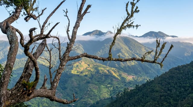
Catherine's Peak
A 1,542-metre summit above Newcastle in the Blue Mountains, climbed on a steep road in about two hours.
Updated 2 September 2026
Catherine's Peak rises to 1,542 metres directly above the Newcastle military camp, and the way up is a steep concrete and dirt road built to serve the transmitter masts on the summit, which makes it a straightforward if lung-testing walk of about two hours. It is named after Catherine Long, said to have been the first woman to climb it in the eighteenth century. From the top, Kingston and the harbour are below on one side and the ridges run away on the other.
What you'll find
- The summit - a 1,542-metre high point with masts and a clear all-round view.
- The Kingston view - the city and harbour spread out below to the south.
- The Newcastle camp - the old British hill station parade ground at the start.
- The cloud forest - tree ferns and mist forest along the upper road.
When to go
December to April is the drier season and the clearest. Cloud closes the summit from late morning most days, so an early start matters. Rain makes the road slippery.
What to expect
The climb is on a service road rather than a trail, so it is a walk rather than a hike. Cloud blocks the view more often than not after mid-morning. There is no water on the route.
Nearby
Newcastle is at the trailhead, and Hollywell is further along the ridge road.
What to pack for Catherine's Peak
Chosen from what this place is for. Tap a kit for the full checklist.
- Broken-in walking shoes or boots - Grip and ankle support matter more than looks; never hike in brand-new boots. Find on Amazon
- Layers for big temperature swings - Warm sun by day, near-freezing at night, even near the equator. Find on Amazon
- Layers + a waterproof shell - Mountain weather turns fast; a packable rain jacket saves the day. Find on Amazon
- Extra-strong sun protection - Thin air means fierce UV; hat, sunglasses and high-SPF sunscreen. Find on Amazon
Some links on this page are Amazon affiliate links - if you buy through them we may earn a small commission at no extra cost to you.
All packing kitsPlan your trip
Where to start if Catherine's Peak is going on the list.
Booking links on this page are affiliate links - if you book through them we may earn a small commission at no extra cost to you. It never changes what we write about a place.
Opening times, ticket prices and seasonal closures change - check the official source before you go: official site.