Mount Batur
An active volcano inside a much larger caldera in northeast Bali, climbed before dawn for sunrise over the crescent lake.
Updated 29 August 2026
AI illustration
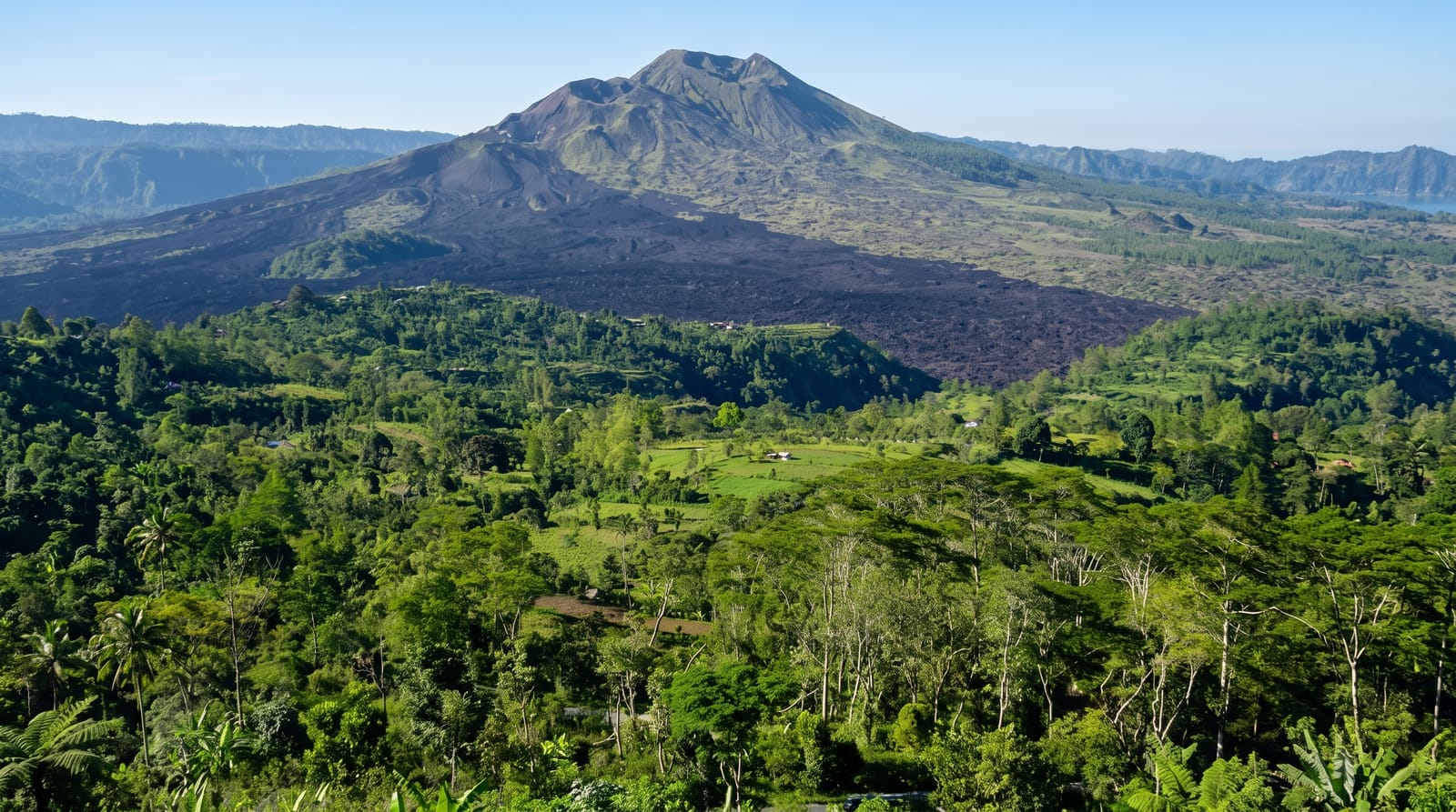
Batur is a young cone sitting inside an old caldera in the highlands of northeast Bali, with a crescent-shaped lake filling the low ground beside it. The standard trip is a two-hour climb starting around two in the morning, on a loose path of ash and scree, to reach the crater rim in time for sunrise over Mount Abang and, on a clear day, Rinjani away across the strait on Lombok. Steam still leaks from vents near the top and guides use them to warm eggs. Below, black lava fields from twentieth-century eruptions run down towards the lake, and hot springs on the shore are the usual stop afterwards.
What you'll find
- The sunrise from the rim - first light over Abang, Agung and the sea beyond.
- The steaming vents - fumaroles near the summit, still warm enough to cook on.
- Lake Batur - the crescent lake in the caldera floor, with hot springs on its shore.
- The lava fields - black flows from twentieth-century eruptions cutting across the caldera.
When to go
April to October gives the best odds of a clear sunrise; in the wet season the summit is usually in cloud and the path turns to mud. Groups leave hotels in south Bali around midnight. Bring a fleece, a head torch and proper shoes: it is cold and dark at the top before dawn.
What to expect
Climbing without a local guide is effectively not allowed, and the guides' association sets the price, which is high for a two-hour walk. The path is a queue of head torches in high season and the rim gets crowded. Cloud ruins the sunrise often enough to matter. The night start plus a long drive makes for a wrecked day afterwards.
Nearby
Kintamani's rim viewpoints, the hot springs at Toya Bungkah and Ubud are within reach.
Key facts
Source: Wikidata, item Q43876, read on 18 October 2026.
What to pack for Mount Batur
Chosen from what this place is for. Tap a kit for the full checklist.
- Broken-in walking shoes or boots - Grip and ankle support matter more than looks; never hike in brand-new boots. Find on Amazon
- Layers for big temperature swings - Warm sun by day, near-freezing at night, even near the equator. Find on Amazon
- Swimwear - Needed at most public thermal pools; some traditional baths are nude and single-sex. Find on Amazon
- Layers + a waterproof shell - Mountain weather turns fast; a packable rain jacket saves the day. Find on Amazon
Some links on this page are Amazon affiliate links - if you buy through them we may earn a small commission at no extra cost to you.
All packing kitsPlan your trip
Where to start if Mount Batur is going on the list.
Booking links on this page are affiliate links - if you book through them we may earn a small commission at no extra cost to you. It never changes what we write about a place.
Opening times, ticket prices and seasonal closures change - check the official source before you go: official site.