Natuna Islands
Indonesia's northernmost islands, a granite-boulder coast in the South China Sea closer to Borneo than to Java.
Updated 19 October 2026
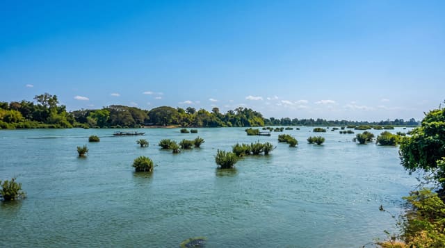
The Natuna group sits at the northern edge of Indonesian territory in the South China Sea, closer to Vietnam and Malaysian Borneo than to Java, and the largest island, Natuna Besar, has the district town of Ranai under Gunung Ranai, a granite massif rising to over a thousand metres. The coastline is the thing: enormous rounded granite boulders piled along beaches at Alif Stone Park and elsewhere, weathered into shapes and scattered into the shallows, with white sand between them. Offshore are reefs and small islands. The waters are economically significant - the Natuna gas fields are large. Tourism is minimal.
History
Claims that the Tang monk I-Tsing discovered or mentioned the islands are disputed by historians, who see them as misreadings of later records. In 1597 the Sultan of Johor, Alauddin Riayat Shah III, and the Green Queen of the Pattani kingdom declared the islands their condominium (Wikipedia, Natuna Islands).
The landscape
- Piled granite boulders - the weathered rock coast at Alif Stone Park and along the shore.
- Gunung Ranai - the granite massif over the district town.
- Reefs and offshore islets - clear water with very few boats.
- Indonesia's northern edge - closer to Vietnam and Borneo than to Java.
When to go
March to October; the monsoon makes the sea rough. Four days.
Practical notes
Access is by small aircraft on limited schedules. Accommodation and food options are basic. Banking is limited. The area is strategically sensitive; be sensible about photographing installations.
Nearby
The Anambas Islands are south-west; Pontianak and Borneo are south.
Key facts
Source: Wikidata, item Q24854716, read on 18 October 2026.
What to pack for Natuna Islands
Chosen from what this place is for. Tap a kit for the full checklist.
- Reef-safe sunscreen - High SPF that will not bleach the coral you are swimming over. Find on Amazon
- Strong insect repellent - DEET or picaridin; the jungle is where bites and disease risk are highest. Find on Amazon
- Quick-dry towel - A microfibre towel packs small and dries in minutes. Find on Amazon
- Long, light, quick-dry clothing - Covers skin from insects and sun without cooking you in the humidity. Find on Amazon
Some links on this page are Amazon affiliate links - if you buy through them we may earn a small commission at no extra cost to you.
All packing kitsPlan your trip
Where to start if Natuna Islands is going on the list.
Booking links on this page are affiliate links - if you book through them we may earn a small commission at no extra cost to you. It never changes what we write about a place.
Opening times, ticket prices and seasonal closures change - check the official source before you go: official site.