Zuluk
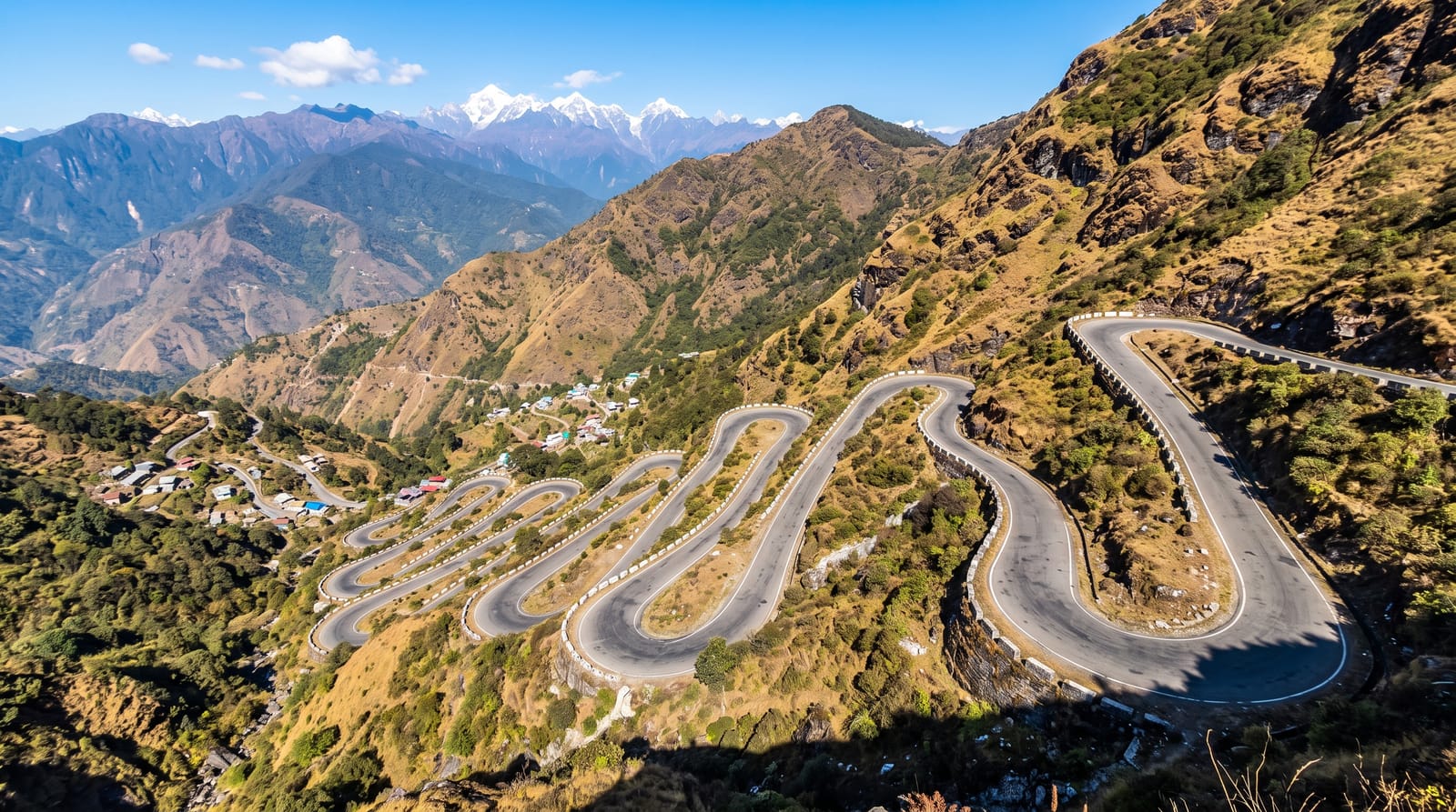
A village on the old Silk Route where the road climbs in around thirty-two visible hairpin loops.
Updated 19 October 2026
AI illustration
Zuluk sits at about 2,900 metres on the old trade route that ran from Kalimpong over the Jelep La into the Chumbi valley and on to Lhasa, a road used by mule caravans until the mid-twentieth century and later rebuilt by the army. Above the village the road climbs in a series of tight hairpins, commonly counted at around thirty-two, stacked so that the whole zigzag is visible at once from Thambi View Point, which is the image the place is known for. From the same point Kanchenjunga can be seen at sunrise. Homestays in the village provide the only accommodation, and the area is heavily militarised.
History
Dzuluk was once a transit point on the trade route between Kalimpong and Tibet, used by traders as an overnight stop on the way to the Jelep La; the route ran from Kalimpong through Pedong, Aritar, Dzuluk and the pass to the Chumbi valley (Wikipedia, Dzuluk).
Highlights
- The hairpin loops - around thirty-two switchbacks visible in one view.
- Thambi View Point - the overlook above the loops, used for sunrise.
- The old Silk Route - the trade road toward the Jelep La pass.
- The village homestays - family accommodation, the only option here.
When to go
March to May and September to December; the monsoon brings landslides and winter snow closes the higher road. Sunrise from Thambi is the reason to stay overnight.
Things to know
Permits are compulsory and foreign nationals are generally not allowed on this route. Accommodation is basic homestays with no heating. Altitude and cold are significant, and the road is narrow with military traffic.
Nearby
Rongli lies below; Nathu La is northwest.
Key facts
Source: Wikidata, item Q28173156, read on 18 October 2026.
What to pack for Zuluk
Chosen from what this place is for. Tap a kit for the full checklist.
- Warm base layers - Merino or synthetic against the skin - never cotton, which chills when damp. Find on Amazon
- Strong insect repellent - DEET or picaridin; the jungle is where bites and disease risk are highest. Find on Amazon
- Comfortable walking shoes - Sightseeing means kilometres of pavement and cobbles daily. Find on Amazon
- Shelter suited to the place - Tent, tarp or hut booking - match it to the terrain and rules. Find on Amazon
Some links on this page are Amazon affiliate links - if you buy through them we may earn a small commission at no extra cost to you.
All packing kitsPlan your trip
Where to start if Zuluk is going on the list.
Booking links on this page are affiliate links - if you book through them we may earn a small commission at no extra cost to you. It never changes what we write about a place.
Opening times, ticket prices and seasonal closures change - check the official source before you go: official site.