Nubra Valley
Sand dunes at three thousand metres with Bactrian camels grazing sea buckthorn between them.
Updated 19 October 2026

AI illustration
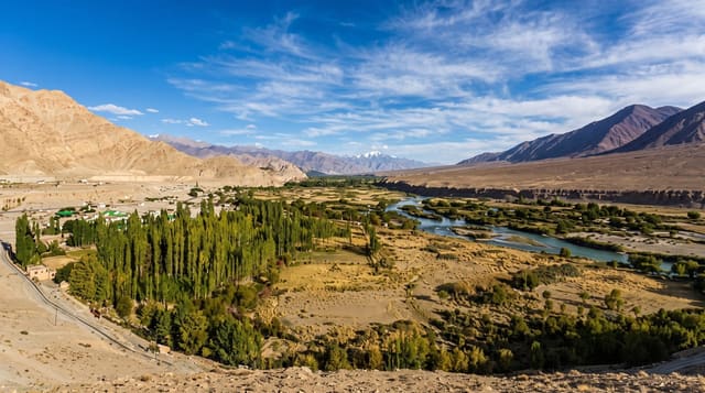
The Shyok and Nubra rivers meet in a broad valley north of the Ladakh range at around 3,000 to 3,200 metres, and where the rivers braid across the floor the wind has piled cold sand into dunes at Hunder, an improbable desert with snow peaks above it. Bactrian camels, two-humped and descended from animals used on the Central Asian caravan routes, graze the sea buckthorn scrub and are ridden by visitors. Diskit monastery, of the fourteenth century, sits on a crag above the valley with a thirty-two metre Maitreya statue below it, and villages of apricot and barley line the water.
History
The name Nubra is believed to come from the Tibetan Ldumra or Dumra, "valley of flowers", for the fertile, orchard-rich valley set in the high desert, though in Ladakhi it can also mean "western". The Nubra River was historically called the Yarma Tsangpo in Tibetan sources, and the modern name seems to come from the valley (Wikipedia, Nubra).
What you'll find
- The Hunder dunes - cold desert sand between snow peaks.
- The Bactrian camels - two-humped caravan-descended animals on the scrub.
- Diskit monastery - a fourteenth-century gompa with a huge Maitreya below.
- The green villages - apricot and barley along the braided rivers.
When to go
June to September, when Khardung La is reliably open and the valley is green; winter closes access for most visitors. Apricot harvest falls in late summer. Nights are cold year-round.
Practical notes
An Inner Line Permit is required and must be arranged in Leh. The drive crosses a pass over 5,300 metres and altitude sickness is common. Camel rides are short and heavily commercialised.
Nearby
Turtuk lies west down the Shyok; Leh is south over Khardung La.
Key facts
Source: Wikidata, item Q2004108, read on 18 October 2026.
What to pack for Nubra Valley
Chosen from what this place is for. Tap a kit for the full checklist.
- Broken-in walking shoes or boots - Grip and ankle support matter more than looks; never hike in brand-new boots. Find on Amazon
- Warm base layers - Merino or synthetic against the skin - never cotton, which chills when damp. Find on Amazon
- Loose, light, long clothing - Covering up beats bare skin in the desert - and locals dress this way for a reason. Find on Amazon
- Layers for big temperature swings - Warm sun by day, near-freezing at night, even near the equator. Find on Amazon
Some links on this page are Amazon affiliate links - if you buy through them we may earn a small commission at no extra cost to you.
All packing kitsPlan your trip
Where to start if Nubra Valley is going on the list.
Booking links on this page are affiliate links - if you book through them we may earn a small commission at no extra cost to you. It never changes what we write about a place.
Opening times, ticket prices and seasonal closures change - check the official source before you go: official site.