Svartifoss
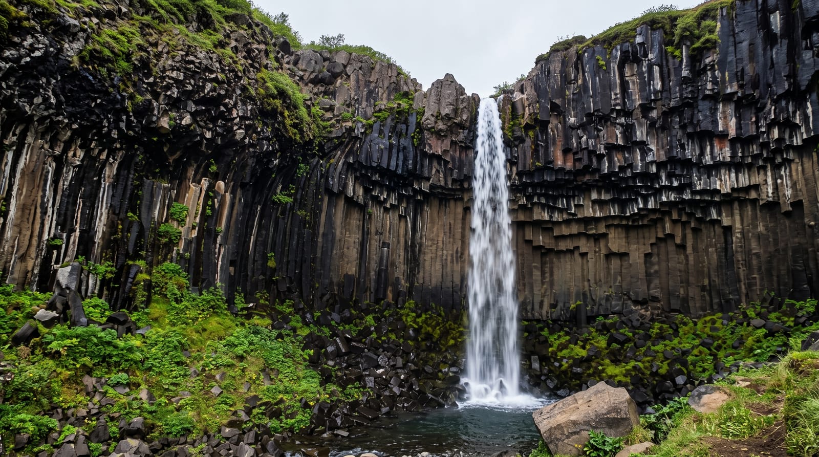
A slim waterfall dropping over a curtain of hexagonal basalt columns, reached by a short uphill walk in Skaftafell.
Updated 30 August 2026
AI illustration
UNESCO World Heritage
Svartifoss is not large, but the rock behind it is the reason people walk up. The water falls about twenty metres over a recess lined with dark hexagonal basalt columns, broken off at the base into a jagged fringe where spray has undercut them. The path from the Skaftafell visitor centre climbs steadily for roughly 1.5 km, passing two smaller falls on the way, and takes most people about forty minutes. Skaftafell is part of Vatnajokull National Park, and the same trail network continues to Sjonarnipa, a viewpoint over the Skaftafellsjokull glacier tongue. The column formation is often cited as an influence on modern Icelandic architecture.
What you'll find
- The basalt colonnade - hexagonal columns framing and overhanging the fall.
- The broken fringe - snapped column ends at the lip, undercut by spray.
- The approach path - the climb past Hundafoss and Magnusarfoss from the visitor centre.
- Sjonarnipa - the trail continuation to a viewpoint over the Skaftafellsjokull glacier tongue.
When to go
May to September for a dry path and long daylight. The fall is modest in volume rather than dependent on high water, so timing matters less than footing. Start early: the visitor centre car park is a fixed point on most coach itineraries and the narrow platform below the fall gets crowded from mid-morning onwards.
Things to know
It is an uphill walk in each direction and the last section is stepped and often wet. The waterfall itself is small; visitors expecting something on the scale of Skogafoss are usually underwhelmed. Parking is charged and enforced. The viewing area is tight, so photographs without other people in them take patience.
Nearby
Skaftafellsjokull is on the same trail network, with Kirkjubaejarklaustur west along the ring road.
Key facts
Source: Wikidata, item Q1145786, read on 18 October 2026.
What to pack for Svartifoss
Chosen from what this place is for. Tap a kit for the full checklist.
- Broken-in walking shoes or boots - Grip and ankle support matter more than looks; never hike in brand-new boots. Find on Amazon
- Warm base layers - Merino or synthetic against the skin - never cotton, which chills when damp. Find on Amazon
- Layers + a waterproof shell - Mountain weather turns fast; a packable rain jacket saves the day. Find on Amazon
- An insulated + windproof jacket - A down or synthetic layer under a hard shell handles most cold. Find on Amazon
Some links on this page are Amazon affiliate links - if you buy through them we may earn a small commission at no extra cost to you.
All packing kitsPlan your trip
Where to start if Svartifoss is going on the list.
Booking links on this page are affiliate links - if you book through them we may earn a small commission at no extra cost to you. It never changes what we write about a place.
Opening times, ticket prices and seasonal closures change - check the official source before you go: official site.