Tung Ping Chau
A layered shale island in the far north-east, reached only at weekends, with corals offshore.
Updated 19 October 2026
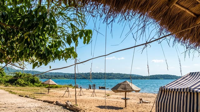
Tung Ping Chau is the easternmost island of Hong Kong, lying far out in Mirs Bay, and it is geologically unlike anywhere else in the territory: made of finely layered sedimentary shale and siltstone laid down in a lake basin, weathering into flat terraces, thin ledges and stacked plates that look built rather than eroded. It forms part of the Hong Kong UNESCO Global Geopark. A coastal path circles the island past the Lung Lok Shui rock ridge running into the sea and past abandoned village houses, and the surrounding water holds some of the best coral cover in Hong Kong, protected as a marine park and snorkelled from the beaches.
History
The now nearly deserted island was once home to a thriving fishing and farming community of 3,000 people with more than 100 fishing junks, living in ten villages, the five oldest being Chau Mei, Chau Tau, Nai Tau, Sha Tau and Tai Tong. In the 1950s about 1,500 people still lived there and two primary schools were built, but the economy declined as fish stocks ran out and people gradually left (Wikipedia, Tung Ping Chau).
What's there
- Layered shale terraces - flat plates and ledges found nowhere else here.
- Lung Lok Shui - the rock ridge running out into the sea.
- Coral in the marine park - the best cover in Hong Kong waters.
- Abandoned village houses - the settlement left behind on the island.
When to go
October to April for walking; summer for snorkelling but with heat and typhoon risk. A day. Ferries run only at weekends and holidays, out in the morning and back in the afternoon.
What to expect
One ferry each way on weekends only, and the crossing takes over an hour and a half; the timetable governs everything. There are no shops and limited food. Shade is scarce on the rock terraces. Camping is the only way to stay.
Nearby
Mirs Bay surrounds the island; Ma Liu Shui pier is on the mainland.
Key facts
Source: Wikidata, item Q167070, read on 18 October 2026.
What to pack for Tung Ping Chau
Chosen from what this place is for. Tap a kit for the full checklist.
- Travel rod + reel - A packable multi-piece rod fits in a case and covers most holiday fishing. Find on Amazon
- Reef-safe sunscreen - High SPF that will not bleach the coral you are swimming over. Find on Amazon
- Your own mask + snorkel - A well-fitting mask is the single biggest comfort upgrade underwater. Find on Amazon
- Shelter suited to the place - Tent, tarp or hut booking - match it to the terrain and rules. Find on Amazon
Some links on this page are Amazon affiliate links - if you buy through them we may earn a small commission at no extra cost to you.
All packing kitsPlan your trip
Where to start if Tung Ping Chau is going on the list.
Booking links on this page are affiliate links - if you book through them we may earn a small commission at no extra cost to you. It never changes what we write about a place.
Opening times, ticket prices and seasonal closures change - check the official source before you go: official site.