Cusuco National Park
Cloud forest in the Merendon range above San Pedro Sula, one of the most intensively surveyed forests in Central America.
Updated 18 October 2026
Cusuco covers the Merendón range west of San Pedro Sula, and it has been the subject of long-running biological survey work that has turned it into one of the best-documented cloud forests in the region. The species list is heavy with amphibians and reptiles found only here or nearly so, including the Cusuco spike-thumb frog, and quetzals breed in the upper forest. The park is named for the armadillo. Access is through the village of Buenos Aires and everything beyond it is walked.
History
The park was established on 1 January 1959 in the Merendón mountains of north-west Honduras. It covers about 23,400 hectares, a core zone of 7,690 hectares inside a wider buffer, rising from just above sea level in the west to 2,425 metres, with dwarf cloud forest above 2,000 metres (Wikipedia, Cusuco National Park).
The landscape
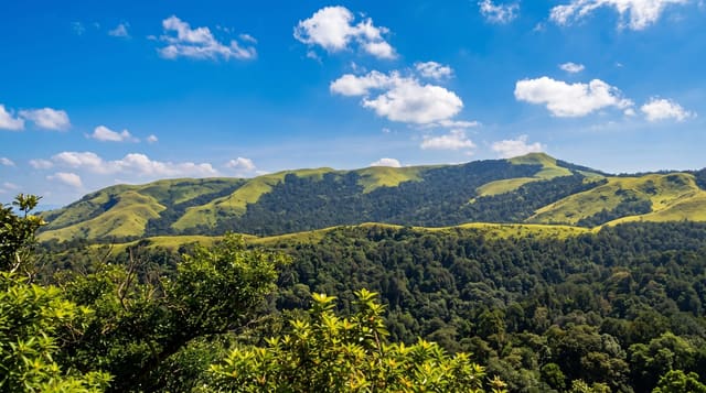
- The cloud forest - dense wet montane forest with tree ferns and heavy epiphyte cover.
- The amphibians - a herpetofauna list including species restricted to this massif.
- The quetzals - breeding in the upper forest, most reliably heard in spring.
- The research camps - long-running survey stations that document the park.
When to go
December to April is the drier season and the only practical window for the road. Rain falls in most months. Quetzal breeding season around March to June is the best for sightings and the wettest for walking.
Things to know
The road up from Cofradia is genuinely bad and needs a four-wheel drive in any season. Facilities are camping and basic village lodging. Trails are steep, wet and slippery, and the forest interior is hard going.
Nearby
San Pedro Sula is east on the plain, and Lake Yojoa is southeast.
Key facts
Source: Wikidata, item Q5196587, read on 18 October 2026.
What to pack for Cusuco National Park
Chosen from what this place is for. Tap a kit for the full checklist.
- Broken-in walking shoes or boots - Grip and ankle support matter more than looks; never hike in brand-new boots. Find on Amazon
- Binoculars - The single best wildlife tool - even a compact pair transforms a sighting. Find on Amazon
- Shelter suited to the place - Tent, tarp or hut booking - match it to the terrain and rules. Find on Amazon
- Layers + a waterproof shell - Mountain weather turns fast; a packable rain jacket saves the day. Find on Amazon
Some links on this page are Amazon affiliate links - if you buy through them we may earn a small commission at no extra cost to you.
All packing kitsPlan your trip
Where to start if Cusuco National Park is going on the list.
Booking links on this page are affiliate links - if you book through them we may earn a small commission at no extra cost to you. It never changes what we write about a place.
Opening times, ticket prices and seasonal closures change - check the official source before you go: official site.