Pavlopetri
A Bronze Age town lying three to four metres under clear water, with streets and house walls visible from the surface.
Updated 19 October 2026
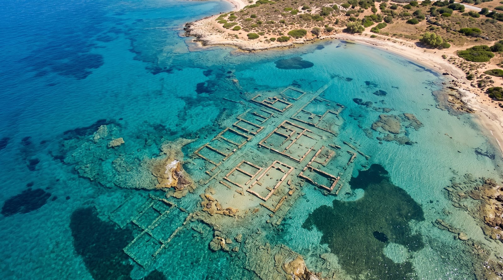
AI illustration
Pavlopetri is generally described as the oldest submerged town site yet found, occupied from around 3500 BC and sunk by earthquakes and rising seas by about 1000 BC. It lies in three to four metres of water between the Pounta shore and Elafonisos, and because the water is exceptionally clear and shallow, the plan is legible from the surface: streets, courtyards, house foundations, and rock-cut chamber tombs, spread over some nine acres. Underwater surveys mapped it in detail with sonar and produced a full digital reconstruction. There is no museum, no boardwalk and no guide on site; you swim out from the beach with a mask and look down. Boat anchoring damages the site, and it has appeared on watch lists of threatened underwater heritage.
History
The ruins were first dated to the Mycenaean period, 1600-1100 BCE, but later studies showed occupation going back to 3500 BCE, so that the site also holds finds from the Final Neolithic, the Chalcolithic, the Bronze Age and Middle Minoan times (Wikipedia, Pavlopetri).
Highlights
- The street plan - lines of walls and lanes visible through the water.
- The house foundations - rectangular outlines of Bronze Age buildings.
- The tombs - rock-cut graves near the shoreline.
- The clear shallows - three to four metres of transparent water over the site.
When to go
Calm summer days, when there is no swell to stir the sand; morning light is best for seeing down. Wind from the south makes the water murky and the swim unpleasant.
What to expect
You need a mask and reasonable swimming ability, and the site can be hard to identify at first: it looks like faint stone lines on a sandy floor. Nothing is signposted, nothing is raised. Do not stand on the walls or anchor above them.
Nearby
Elafonisos and its beaches are across the strait; Monemvasia is an hour north.
Key facts
Source: Wikidata, item Q966038, read on 18 October 2026.
What to pack for Pavlopetri
Chosen from what this place is for. Tap a kit for the full checklist.
- Reef-safe sunscreen - High SPF that will not bleach the coral you are swimming over. Find on Amazon
- Comfortable walking shoes - Sightseeing means kilometres of pavement and cobbles daily. Find on Amazon
- Quick-dry towel - A microfibre towel packs small and dries in minutes. Find on Amazon
- A slim anti-theft daypack - Zips that close properly; keep it in front in crowds and on transit. Find on Amazon
Some links on this page are Amazon affiliate links - if you buy through them we may earn a small commission at no extra cost to you.
All packing kitsPlan your trip
Where to start if Pavlopetri is going on the list.
Booking links on this page are affiliate links - if you book through them we may earn a small commission at no extra cost to you. It never changes what we write about a place.
Opening times, ticket prices and seasonal closures change - check the official source before you go: official site.