Quiberon Peninsula
A peninsula so narrow it nearly becomes an island, with a sheltered coast on one side and a violent one on the other.
Updated 21 October 2026
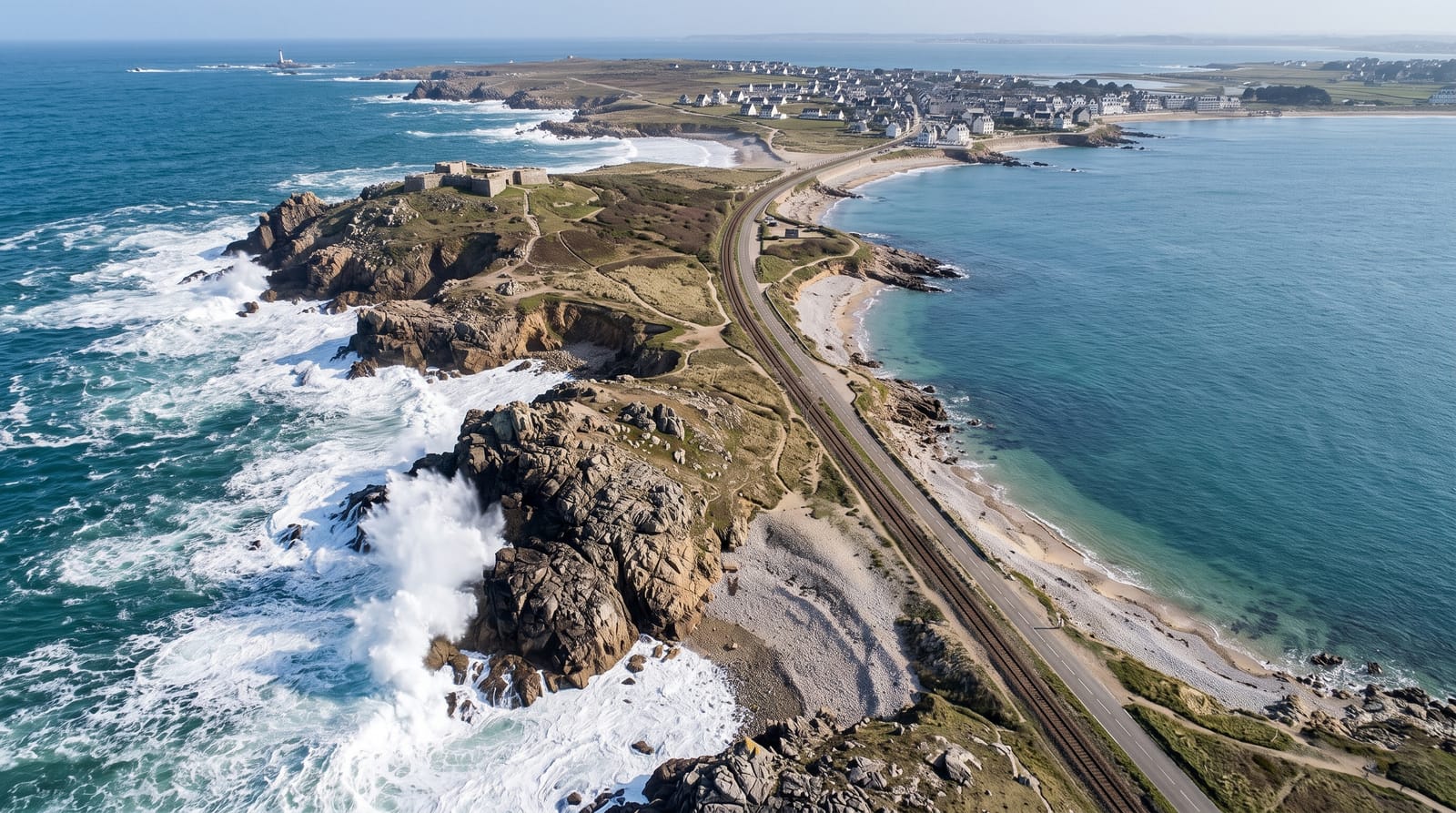
AI illustration
Quiberon runs about fourteen kilometres south from the mainland on an isthmus that narrows to around a hundred metres at Penthievre, and the two sides could not be more different: the eastern shore is sheltered with calm beaches and the harbour, while the western is the Cote Sauvage, an exposed Atlantic front of low cliffs, blowholes, stacks and heavy surf where swimming is prohibited outright and people are regularly swept off. The contrast is the point of the place. Ferries to Belle-Ile and the smaller islands leave from Quiberon, and the peninsula is a centre for surfing, kitesurfing and thalassotherapy.
What's there
- The Cote Sauvage - an exposed western coast of cliffs, stacks and surf.
- The sheltered east - calm beaches and the harbour on the other side.
- The Penthievre isthmus - the neck narrowing to about a hundred metres.
- The island ferries - departures for Belle-Ile, Houat and Hoedic.
When to go
May to September; the peninsula jams with traffic in August and the seasonal train helps. Winter storms on the Cote Sauvage are spectacular and dangerous.
What to expect
Swimming on the Cote Sauvage is prohibited. Summer traffic down the single road is severe. Ferries to the islands book out in August.
Nearby
Belle-Ile lies offshore; Carnac is northeast.
Key facts
Source: Wikidata, item Q2867477, read on 18 October 2026.
What to pack for Quiberon Peninsula
Chosen from what this place is for. Tap a kit for the full checklist.
- Broken-in walking shoes or boots - Grip and ankle support matter more than looks; never hike in brand-new boots. Find on Amazon
- Reef-safe sunscreen - High SPF that will not bleach the coral you are swimming over. Find on Amazon
- Quick-dry clothing - Board shorts or synthetics that shrug off spray and dry fast. Find on Amazon
- Layers + a waterproof shell - Mountain weather turns fast; a packable rain jacket saves the day. Find on Amazon
Some links on this page are Amazon affiliate links - if you buy through them we may earn a small commission at no extra cost to you.
All packing kitsPlan your trip
Where to start if Quiberon Peninsula is going on the list.
Booking links on this page are affiliate links - if you book through them we may earn a small commission at no extra cost to you. It never changes what we write about a place.
Opening times, ticket prices and seasonal closures change - check the official source before you go: official site.