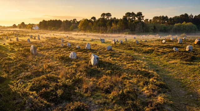
Gulf of Morbihan
An inland sea whose Breton name means little sea, scattered with islands and drained through one narrow mouth.
Updated 4 September 2026

AI illustration
Mor bihan is Breton for little sea, and the gulf is a shallow basin of about a hundred and fifteen square kilometres connected to the Atlantic by a mouth less than a kilometre wide, through which the whole tide has to pass; the current in that channel runs fast enough to be a serious navigational matter. The old claim is that the gulf holds as many islands as days in the year, which is a saying rather than a count; around forty are substantial and two, the Ile aux Moines and the Ile d'Arz, carry villages. Neolithic monuments stand on and around the shores, including a cairn on the Ile de Gavrinis with carved slabs.
Highlights
- The island scatter - dozens of islands across a shallow inland sea.
- The narrow mouth - the tidal channel with fast current at Port-Navalo.
- Gavrinis - a Neolithic cairn on an island with carved stone slabs.
- Ile aux Moines - the largest inhabited island, walked or cycled.
When to go
April to October; boat services run in season with fewer in winter. Gavrinis opens seasonally and needs booking. Bird numbers on the mudflats peak in winter.
What to expect
Boat schedules vary by season and island. Gavrinis has limited daily numbers and books out. Currents in the gulf are strong and swimming near the mouth is dangerous.
Nearby
Vannes lies north; Carnac is west.
Key facts
Source: Wikidata, item Q1144680, read on 18 October 2026.
What to pack for Gulf of Morbihan
Chosen from what this place is for. Tap a kit for the full checklist.
- Broken-in walking shoes or boots - Grip and ankle support matter more than looks; never hike in brand-new boots. Find on Amazon
- Reef-safe sunscreen - High SPF that will not bleach the coral you are swimming over. Find on Amazon
- Layers + a waterproof shell - Mountain weather turns fast; a packable rain jacket saves the day. Find on Amazon
- Quick-dry towel - A microfibre towel packs small and dries in minutes. Find on Amazon
Some links on this page are Amazon affiliate links - if you buy through them we may earn a small commission at no extra cost to you.
All packing kitsPlan your trip
Where to start if Gulf of Morbihan is going on the list.
Booking links on this page are affiliate links - if you book through them we may earn a small commission at no extra cost to you. It never changes what we write about a place.
Opening times, ticket prices and seasonal closures change - check the official source before you go: official site.