Les Baux-de-Provence
A ruined citadel on a limestone spur, above the quarries that gave bauxite its name.
Updated 19 October 2026
AI illustration
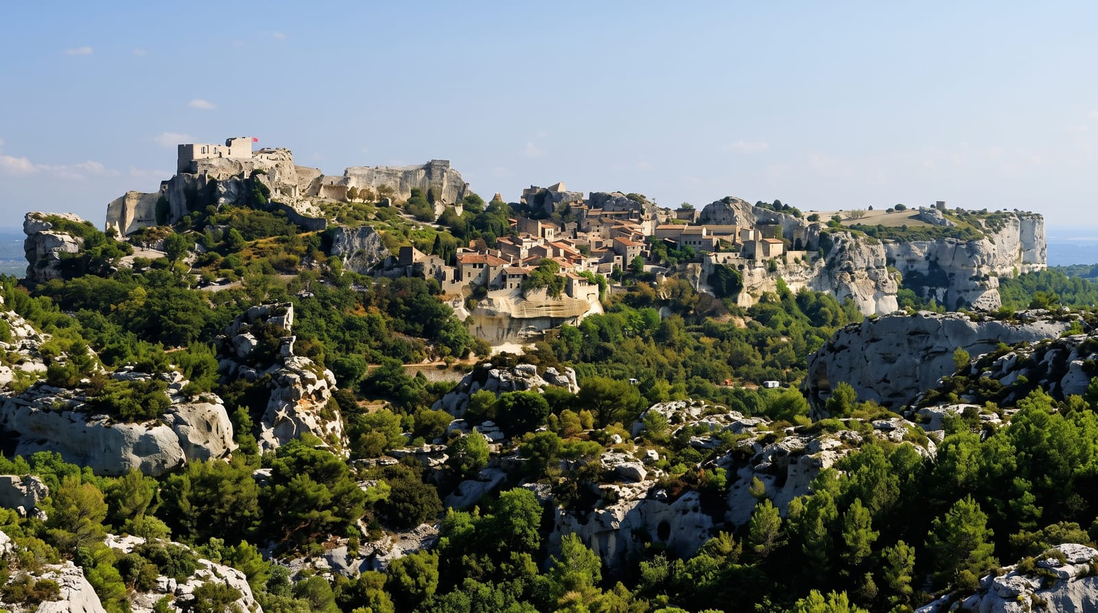
Les Baux occupies a limestone spur in the Alpilles with vertical drops on three sides, and the lords of Baux ruled a large part of Provence from it until Louis XI had the fortress dismantled in 1483; Richelieu finished the job in 1631. What remains is a ruined citadel spread over about seven hectares, with rooms cut into the rock, a keep to climb and reconstructed siege engines demonstrated in season. The mineral bauxite was identified in the quarries below in 1821 and takes its name from the village. The old village street below the citadel is intact but almost entirely given over to shops.
History
People lived here by 6000 BC, as shown by the Costapéra cave, found in 1928, with burials of the early Bronze Age, and the Celts held the spur as an oppidum around the 2nd century BC; limestone was quarried from the end of the 2nd century BC. In the Middle Ages the fortress, built over seven hectares from the 11th to the 13th century, was the seat of a domain of 79 towns and villages, whose princes claimed descent from Balthazar, one of the Magi, bearing his sixteen-pointed star and the motto "Au hasard, Balthazar". Defeated at the end of the Baussenque Wars in the 12th century, they kept a court famed for its culture and chivalry until the line died out in the 15th century. The mineral bauxite was named after the village when the geologist Pierre Berthier first found it here in 1821, and the commune took the name Les Baux-de-Provence on 13 August 1958 (Wikipedia, Les Baux-de-Provence).
The main sights
- The ruined citadel - seven hectares of walls, rock-cut rooms and a keep.
- The Alpilles panorama - the plain and hills from the cliff edge.
- The siege engines - reconstructed trebuchets demonstrated in season.
- The village street - the intact lane below the fortress.
When to go
April to June and September to October; summer is very hot on bare rock with no shade and extremely crowded. The mistral hits the exposed plateau hard.
Good to know
The village is one of the most visited in France and the single street is wall-to-wall shops and coach groups. The citadel is exposed with uneven footing and no shade. Parking is outside and charged.
Nearby
The Carrieres de Lumieres are a few hundred metres away; Saint-Remy lies north.
What to pack for Les Baux-de-Provence
Chosen from what this place is for. Tap a kit for the full checklist.
- Head torch + spare batteries - Hands-free light is essential; caves are truly dark. Find on Amazon
- Comfortable walking shoes - Sightseeing means kilometres of pavement and cobbles daily. Find on Amazon
- Grippy closed shoes - Cave floors are wet, muddy and slick with formations. Find on Amazon
- A slim anti-theft daypack - Zips that close properly; keep it in front in crowds and on transit. Find on Amazon
Some links on this page are Amazon affiliate links - if you buy through them we may earn a small commission at no extra cost to you.
All packing kitsPlan your trip
Where to start if Les Baux-de-Provence is going on the list.
Booking links on this page are affiliate links - if you book through them we may earn a small commission at no extra cost to you. It never changes what we write about a place.
Opening times, ticket prices and seasonal closures change - check the official source before you go: official site.