Dentelles de Montmirail
Limestone slabs tilted to vertical and weathered into thin blades, standing over Rhone vineyards.
Updated 19 October 2026
AI illustration
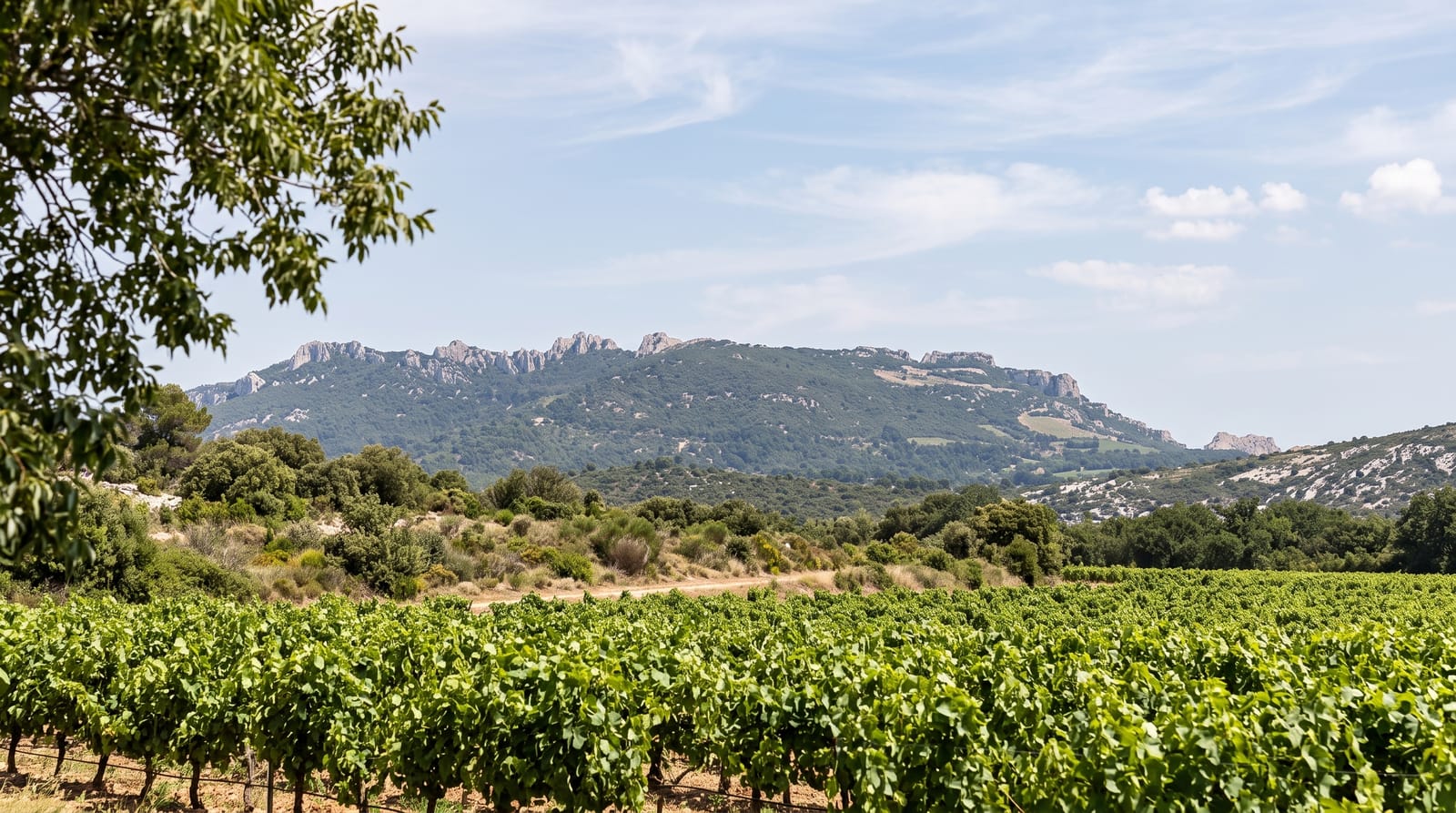
The Dentelles are Jurassic limestone beds that Alpine folding stood on end, after which erosion cut them into thin parallel blades; dentelle means lace, and the name comes from the fretted look of the ridges rather than from any height, since the top point is only about seven hundred and thirty metres. They rise straight out of vineyard country, which gives the classic Provencal composition of pale rock over vines. Gigondas, Vacqueyras and Beaumes-de-Venise all lie at their foot. The rock is popular with climbers and the ridges are crossed by marked paths with steep, exposed sections.
History
The name comes from dentelles, French for lace, after the fretted shape erosion has given the ridges, and from the Latin mons mirabilis, "admirable mountain". Spread over the communes of Beaumes-de-Venise, Gigondas, Vacqueyras, Malaucène and others, the range was an important natural frontier in antiquity between the Memini to the south and the Vocontii to the north (Wikipedia, Dentelles de Montmirail).
What's there
- The blade ridges - vertical limestone beds eroded into thin fins.
- The vineyard foreground - Gigondas and Vacqueyras vines below the rock.
- The col walks - marked paths crossing between the ridges.
- The climbing routes - bolted lines on the sunlit faces.
When to go
April to June and September to October; summer is hot and exposed with fire restrictions possible. Autumn colour in the vines against the pale rock is the best combination.
Before you go
Paths on the ridges are steep, rocky and exposed in places, with drops. There is no water and little shade. Roads between the villages are narrow and busy at harvest.
Nearby
Vaison-la-Romaine lies north; Mont Ventoux is east.
Key facts
Source: Wikidata, item Q1189890, read on 18 October 2026.
What to pack for Dentelles de Montmirail
Chosen from what this place is for. Tap a kit for the full checklist.
- Broken-in walking shoes or boots - Grip and ankle support matter more than looks; never hike in brand-new boots. Find on Amazon
- Layers + a waterproof shell - Mountain weather turns fast; a packable rain jacket saves the day. Find on Amazon
- Daypack with rain cover - 20-30 litres holds water, snacks, layers and a first-aid kit. Find on Amazon
- Offline maps + a power bank - Download the trail before you lose signal; carry backup charge. Find on Amazon
Some links on this page are Amazon affiliate links - if you buy through them we may earn a small commission at no extra cost to you.
All packing kitsPlan your trip
Where to start if Dentelles de Montmirail is going on the list.
Booking links on this page are affiliate links - if you book through them we may earn a small commission at no extra cost to you. It never changes what we write about a place.
Opening times, ticket prices and seasonal closures change - check the official source before you go: official site.